
}
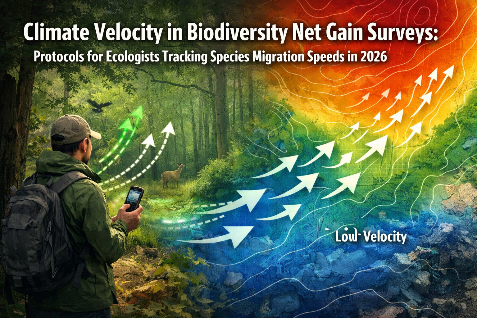
Species are moving three times faster than predicted just five years ago. As climate zones shift at unprecedented rates, ecologists conducting Biodiversity Net Gain (BNG) surveys face a critical challenge: how do you calculate accurate biodiversity baselines when the species you're counting today might relocate tomorrow? Climate Velocity in Biodiversity Net Gain Surveys: Protocols for Ecologists Tracking Species Migration Speeds in 2026 has become essential knowledge for professionals ensuring development projects meet regulatory requirements while accounting for dynamic ecological systems.
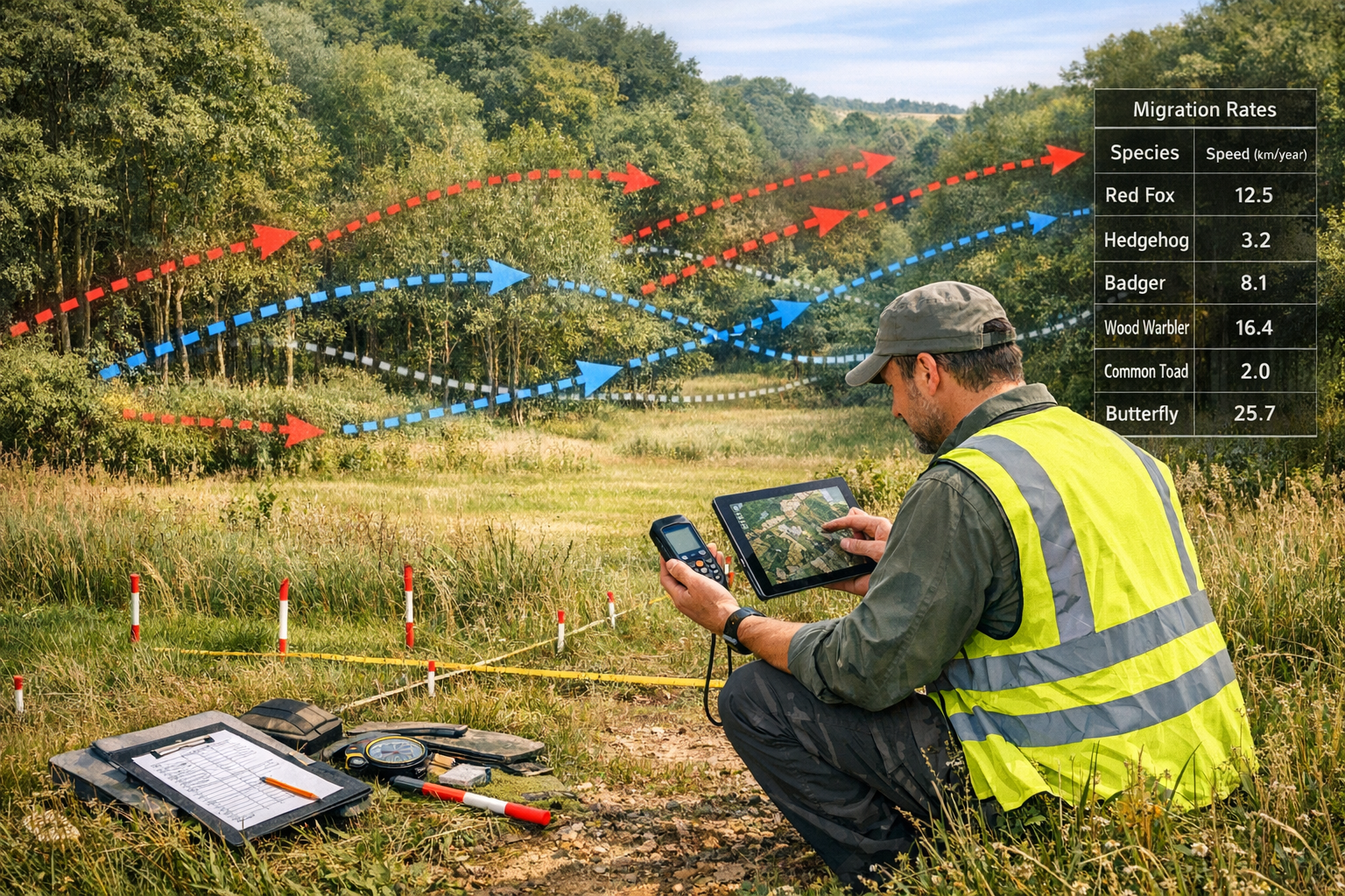
The UK government's confirmation that mandatory 10% BNG will apply to Nationally Significant Infrastructure Projects from November 2026 makes this challenge even more urgent.[1] With species ranges shifting northward at average rates of 6.1 kilometers per decade in the UK, traditional survey methods that assume static populations are becoming obsolete. Ecologists must now integrate climate velocity metrics—the speed and direction at which species must move to maintain suitable climate conditions—into their BNG assessments.
This article provides comprehensive field protocols combining GPS tracking, predictive modeling, and updated survey methodologies to ensure accurate net gain calculations in an era of rapid ecological change.
Key Takeaways
- Climate velocity metrics now essential for accurate BNG surveys as species shift ranges 3x faster than previous predictions
- Integrated GPS tracking combined with predictive modeling provides reliable baseline data accounting for migration patterns
- Updated field protocols must incorporate temporal sampling across seasons to capture population dynamics
- Regulatory compliance requires BNG boundary plans that anticipate species range shifts over 30-year habitat management periods
- De minimis exemption of 0.2 hectares means focused efforts on larger developments with greater ecological impact[2]
Understanding Climate Velocity and Its Impact on BNG Assessments
Climate velocity measures the speed at which organisms must migrate to maintain their current climate conditions as global temperatures rise. For ecologists conducting BNG surveys, this concept fundamentally changes how baseline biodiversity is assessed and future habitat value is predicted.
What Climate Velocity Means for UK Biodiversity
Climate velocity varies significantly across landscapes. In flat, homogeneous terrain, species may need to migrate hundreds of kilometers to find suitable conditions. In topographically diverse areas like the UK's uplands, suitable microclimates might exist just meters away at different elevations.
Key velocity patterns affecting UK surveys:
- 🌡️ Temperature-driven shifts: Average 6.1 km/decade northward movement
- 🏔️ Elevation migrations: Upslope movement of 11 meters per decade
- 💧 Moisture gradient changes: Eastern species moving toward wetter western regions
- 🌊 Coastal squeeze: Limited migration options for coastal species
Research from Harvard University's Salata Institute demonstrates that nature-based solutions can reduce costs by 30% while providing climate adaptation benefits—a critical consideration when planning BNG habitat creation that must remain viable as species ranges shift.[3]
Why Traditional BNG Surveys Fall Short
Standard BNG assessments typically involve:
- Single-season habitat surveys
- Static species inventories
- Fixed habitat condition assessments
- Baseline calculations assuming stable populations
These approaches fail to account for temporal dynamics in species distributions. A woodland surveyed in spring 2026 might show healthy populations of temperature-sensitive species that will become locally extinct by 2030 as climate zones shift.
When calculating biodiversity unit gains, ecologists must now consider:
- Colonization potential: Will target species naturally arrive at created habitats?
- Extinction risk: Will baseline species persist through the 30-year management period?
- Habitat trajectory: Will created habitats remain climatically suitable?
- Connectivity requirements: Do migration corridors exist for range-shifting species?
Field Protocols for Climate Velocity in Biodiversity Net Gain Surveys: Tracking Migration Speeds
Implementing Climate Velocity in Biodiversity Net Gain Surveys: Protocols for Ecologists Tracking Species Migration Speeds in 2026 requires systematic integration of new technologies and methodologies into existing survey frameworks.
Essential Equipment and Technology
GPS Tracking Systems
Modern BNG surveys require high-precision GPS equipment for:
- Recording exact survey locations (±1 meter accuracy)
- Mapping habitat boundaries with climate microclimate data
- Tracking repeat survey points across seasons
- Georeferencing species observations for velocity analysis
Recommended specifications:
- Differential GPS with WAAS/EGNOS correction
- Integration with mobile GIS applications
- Cloud synchronization for team collaboration
- Battery life supporting full-day field surveys
Predictive Modeling Software
Several platforms now integrate climate velocity projections:
| Software | Primary Use | Climate Integration |
|---|---|---|
| QGIS + Climate Plugins | Free, open-source mapping | Climate envelope modeling |
| MaxEnt | Species distribution modeling | Future range predictions |
| Zonation | Spatial conservation planning | Climate connectivity analysis |
| UK Habitat Classification | Standardized habitat recording | Temporal change tracking |
Step-by-Step Survey Protocol
Phase 1: Pre-Survey Planning (2-3 weeks before fieldwork)
-
Obtain baseline climate data for survey area
- Historical temperature trends (30-year records)
- Precipitation patterns and projections
- Microclimate variations from topographic analysis
-
Identify climate-sensitive indicator species
- Review local records for range-edge populations
- Prioritize species with documented velocity patterns
- Consider both northward-shifting and contracting ranges
-
Design temporal sampling strategy
- Minimum three seasonal surveys (spring, summer, autumn)
- Align with peak activity periods for target taxa
- Account for phenological shifts due to warming
Phase 2: Field Data Collection
Standard habitat assessment PLUS:
✅ GPS-referenced quadrat sampling
- Permanent marker installation at sampling points
- Precise coordinates recorded for multi-year monitoring
- Microclimate data loggers at representative locations
✅ Extended species inventories
- Document all species, not just habitat indicators
- Record abundance estimates, not just presence/absence
- Note behavioral indicators of thermal stress
✅ Habitat connectivity mapping
- Identify potential migration corridors
- Assess barriers to movement (roads, urban areas, unsuitable habitat)
- Map stepping-stone habitats within 5km radius
✅ Photographic documentation
- Standardized photo points for temporal comparison
- Close-up images of indicator species
- Landscape context showing surrounding habitat matrix
Phase 3: Velocity Analysis and Modeling
After field data collection, integrate findings with climate projections:
- Calculate local climate velocity using terrain analysis
- Model species range shifts using distribution data
- Assess habitat suitability trajectories over 30-year BNG period
- Identify climate refugia within or near development sites
Data Recording Best Practices
When conducting BNG assessments, enhanced data recording ensures future-proofed calculations:
Essential metadata for each survey:
- Date, time, weather conditions, temperature
- Observer names and qualifications
- Survey effort (person-hours, area covered)
- Detection limitations (visibility, access restrictions)
- GPS accuracy readings
- Equipment calibration records
Species-specific records should include:
- Exact location coordinates
- Life stage and behavior observations
- Microhabitat preferences
- Apparent health/stress indicators
- Historical occurrence data for comparison
Integrating Climate Velocity into BNG Calculations and Compliance
The UK's updated BNG regulations require boundary plans and strategic approaches that account for long-term habitat viability.[1] Climate velocity considerations must now inform every stage of BNG planning.
Adjusting Biodiversity Unit Calculations
Traditional BNG metric calculations use:
- Habitat distinctiveness scores
- Habitat condition assessments
- Strategic significance multipliers
- Area measurements
Climate-adjusted calculations add:
Temporal Persistence Factor (TPF)
A multiplier reflecting the probability that baseline habitats will remain climatically suitable over the 30-year management period.
- TPF = 1.0: Habitat within core climate range, low velocity risk
- TPF = 0.8: Habitat at range edge, moderate migration pressure
- TPF = 0.6: Habitat beyond projected climate envelope by 2050
Colonization Probability Score (CPS)
An adjustment for created/enhanced habitats reflecting likelihood that target species will naturally colonize as ranges shift.
- CPS = 1.2: Habitat within projected future range of target species
- CPS = 1.0: Habitat within current range, uncertain future suitability
- CPS = 0.7: Habitat outside projected colonization zones
Designing Climate-Resilient Habitat Creation
When planning on-site or off-site BNG delivery, climate velocity considerations should guide habitat design:
Prioritize climate refugia characteristics:
🌳 Topographic diversity
- Varied elevations providing temperature gradients
- North-facing slopes for cooler microclimates
- Valley bottoms retaining moisture
💧 Water availability
- Permanent water sources buffering drought stress
- Wetland creation in areas with reliable hydrology
- Riparian corridors facilitating movement
🔗 Connectivity enhancement
- Habitat corridors aligned with predicted migration routes
- Stepping-stone patches at 500m intervals
- Removal of movement barriers where possible
🌱 Species selection flexibility
- Native species assemblages from slightly warmer regions
- Genetic diversity supporting local adaptation
- Avoid monocultures vulnerable to single stressors
Compliance Documentation for 2026 Regulations
With BNG now mandatory for NSIPs from November 2026, compliance documentation must demonstrate climate-informed planning:[1]
Required elements in BNG reports:
-
Climate context assessment
- Historical climate trends for site region
- Projected changes over 30-year period
- Local climate velocity calculations
-
Baseline species vulnerability analysis
- Identification of climate-sensitive species
- Range-edge population assessments
- Predicted persistence probabilities
-
Habitat creation rationale
- Climate suitability projections for target habitats
- Colonization pathway analysis
- Adaptive management triggers
-
Monitoring framework
- GPS-referenced permanent sampling points
- Multi-seasonal survey schedule
- Climate indicator species tracking
- Contingency plans for unexpected shifts
Developers seeking to achieve 10% biodiversity net gain must work with ecologists who understand these enhanced requirements.
Case Study Applications: Climate Velocity Protocols in Practice
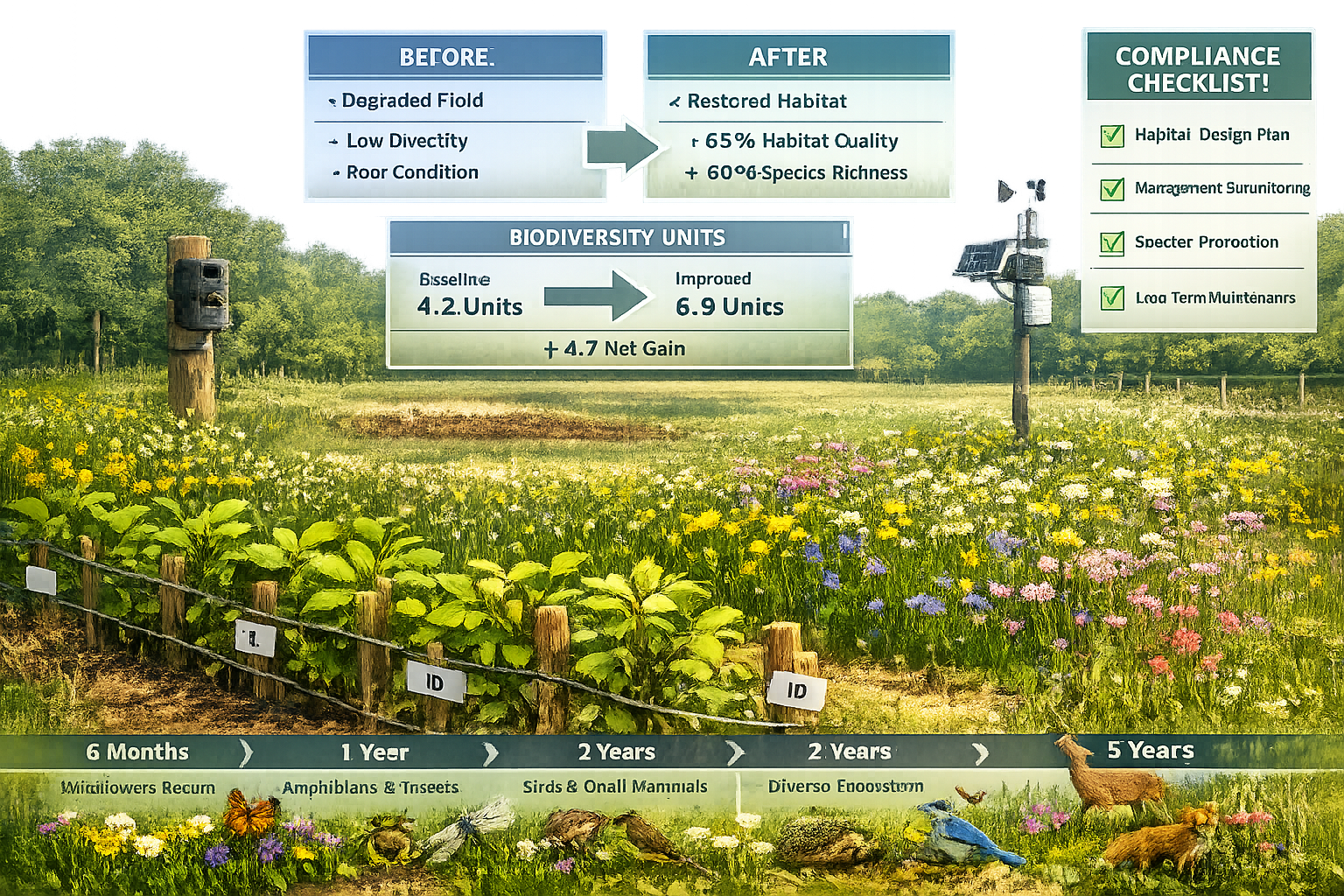
Upland Habitat Restoration Project
A 15-hectare moorland restoration project in the Peak District incorporated climate velocity analysis:
Challenge: Traditional surveys showed healthy populations of mountain ringlet butterflies, but climate modeling predicted local extinction by 2040.
Solution:
- GPS tracking revealed microrefugia in north-facing gullies 200m upslope
- Habitat creation focused on enhancing these cooler zones
- Connectivity corridors established to higher elevations
- Monitoring protocol tracks population shifts toward refugia
Outcome: BNG calculations adjusted to reflect realistic 30-year trajectory, with contingency plans for assisted colonization if natural migration proves insufficient.
Coastal Development with Marine Considerations
Research on marine biodiversity mapping for sustainable ocean management demonstrates similar principles apply to coastal BNG projects.[4][6]
Key considerations:
- Benthic species showing rapid range shifts due to ocean warming
- Intertidal habitat creation must account for sea-level rise
- Fish assemblages changing as southern species expand northward
- Connectivity between marine and terrestrial habitats
Woodland Creation for Biodiversity Units
A biodiversity unit banking project in southern England used climate velocity protocols:
Baseline assessment revealed:
- Several bird species at northern range limits
- Projected northward shift of 8-12 km by 2050
- Opportunity for southern species colonization
Adaptive design:
- Mixed native woodland with species from 100km south
- Structural diversity supporting varied microclimates
- Monitoring for early detection of colonizing species
- Flexible management allowing natural succession
Advanced Techniques: Predictive Modeling for Long-Term BNG Success
Species Distribution Modeling (SDM)
MaxEnt and similar platforms use occurrence data and environmental variables to predict:
- Current species distributions
- Future range projections under climate scenarios
- Habitat suitability scores across landscapes
Application to BNG:
- Input survey data with GPS coordinates
- Add climate variables (temperature, precipitation, elevation)
- Generate current distribution maps
- Project future distributions using UKCP18 climate scenarios
- Identify areas gaining vs. losing suitability
Climate Connectivity Analysis
Linkage Mapper and Circuitscape tools identify:
- Least-cost movement pathways between habitats
- Climate corridors facilitating range shifts
- Pinch points requiring conservation priority
- Barriers preventing species migration
Integration with BNG planning:
- Site creation/enhancement locations along migration routes
- Corridor restoration as BNG delivery mechanism
- Strategic placement of off-site biodiversity units
Phenological Shift Tracking
Climate change affects not just where species occur, but when they're active:
- Earlier spring emergence
- Extended breeding seasons
- Mismatches with food resources
Survey implications:
- Traditional survey windows may miss peak activity
- Multi-seasonal sampling captures shifted phenology
- Behavioral observations indicate adaptation stress
Common Challenges and Solutions
Challenge 1: Data Limitations
Problem: Limited historical occurrence data for velocity calculations
Solutions:
- Collaborate with local records centers
- Use citizen science databases (iRecord, eBird)
- Employ proxy species with better data
- Focus on habitat-level rather than species-level predictions
Challenge 2: Uncertainty in Projections
Problem: Climate models contain inherent uncertainty
Solutions:
- Use ensemble projections (multiple climate scenarios)
- Apply precautionary principle in BNG calculations
- Design flexible habitats supporting multiple outcomes
- Include adaptive management provisions
Challenge 3: Cost and Time Constraints
Problem: Enhanced protocols require more resources
Solutions:
- Prioritize velocity analysis for larger developments
- Use existing climate data rather than new modeling
- Focus on indicator species representing broader communities
- Leverage remote sensing for landscape-scale analysis
Challenge 4: Regulatory Acceptance
Problem: Novel methodologies may face scrutiny from planning authorities
Solutions:
- Provide clear rationale linking to BNG objectives
- Reference peer-reviewed velocity research
- Demonstrate how approach ensures long-term net gain
- Engage early with planning authorities
Training and Professional Development
Ecologists implementing Climate Velocity in Biodiversity Net Gain Surveys: Protocols for Ecologists Tracking Species Migration Speeds in 2026 should pursue:
Technical skills:
- GIS and spatial analysis proficiency
- Species distribution modeling software
- Statistical analysis of temporal data
- Climate science fundamentals
Recommended courses:
- CIEEM climate change adaptation training
- MaxEnt species distribution modeling workshops
- Advanced GPS and field data collection
- Climate velocity analysis methods
Professional resources:
- CIEEM guidance on climate change in ecological assessment
- UK Climate Impacts Programme (UKCIP) resources
- Nature-based Solutions Initiative publications
- BNG statutory guidance updates
Future Directions: BNG in a Changing Climate
As climate velocity accelerates, BNG protocols will continue evolving:
Emerging trends:
- Real-time monitoring: IoT sensors providing continuous habitat data
- AI-powered predictions: Machine learning improving velocity forecasts
- Genetic considerations: Local adaptation and assisted gene flow
- Dynamic baselines: Moving targets replacing static reference conditions
Policy developments:
- Integration of climate resilience into BNG metrics
- Recognition of climate adaptation as ecosystem service
- Enhanced requirements for long-term monitoring
- Incentives for climate-smart habitat creation
The intersection of biodiversity and net zero goals suggests future BNG frameworks will increasingly value carbon sequestration alongside biodiversity units, with nature-based solutions delivering multiple benefits.[3]
Conclusion
Climate Velocity in Biodiversity Net Gain Surveys: Protocols for Ecologists Tracking Species Migration Speeds in 2026 represents a fundamental evolution in ecological assessment methodology. As species ranges shift at unprecedented rates, static survey approaches no longer provide the reliable baselines needed for accurate BNG calculations and long-term habitat planning.
The protocols outlined in this article—combining GPS tracking, predictive modeling, multi-seasonal sampling, and climate-adjusted calculations—ensure BNG assessments reflect ecological reality. With mandatory 10% BNG now applying to major infrastructure projects from November 2026, ecologists must adopt these enhanced methodologies to ensure compliance and deliver genuine, lasting biodiversity improvements.[1]
Actionable next steps for ecologists and developers:
- Audit current survey protocols to identify gaps in climate velocity consideration
- Invest in essential technology: precision GPS equipment and modeling software
- Develop partnerships with climate scientists and spatial analysts
- Pilot enhanced protocols on upcoming projects before regulatory requirements tighten
- Engage early with planning authorities to establish acceptance of climate-informed approaches
- Build monitoring capacity for long-term tracking of habitat trajectories
The species we survey today are already responding to climate signals we're only beginning to understand. By integrating climate velocity into BNG assessments and habitat creation, ecologists can ensure development projects deliver biodiversity improvements that endure through decades of environmental change—not just paper gains that vanish as species migrate beyond project boundaries.
The future of biodiversity net gain depends on our ability to work with, rather than against, the dynamic nature of ecological systems in a changing climate.
References
[1] Government Confirms Biodiversity Net Gain For Major Infrastructure From November 2026 – https://cieem.net/government-confirms-biodiversity-net-gain-for-major-infrastructure-from-november-2026/
[2] The State Of Biodiversity Net Gain In 2026 Key Policy Updates – https://biodiversity-netgain.co.uk/the-state-of-biodiversity-net-gain-in-2026-key-policy-updates/
[3] Climate Biodiiversity News (march 2026) – https://www.asla.org/news-insights/dirt/climate-biodiiversity-news-(march-2026)
[4] Ecs2 – https://esajournals.onlinelibrary.wiley.com/doi/10.1002/ecs2.70494
[6] Cooper Et Al 2026 – https://tethys.pnnl.gov/sites/default/files/publications/Cooper-et-al-2026.pdf
