
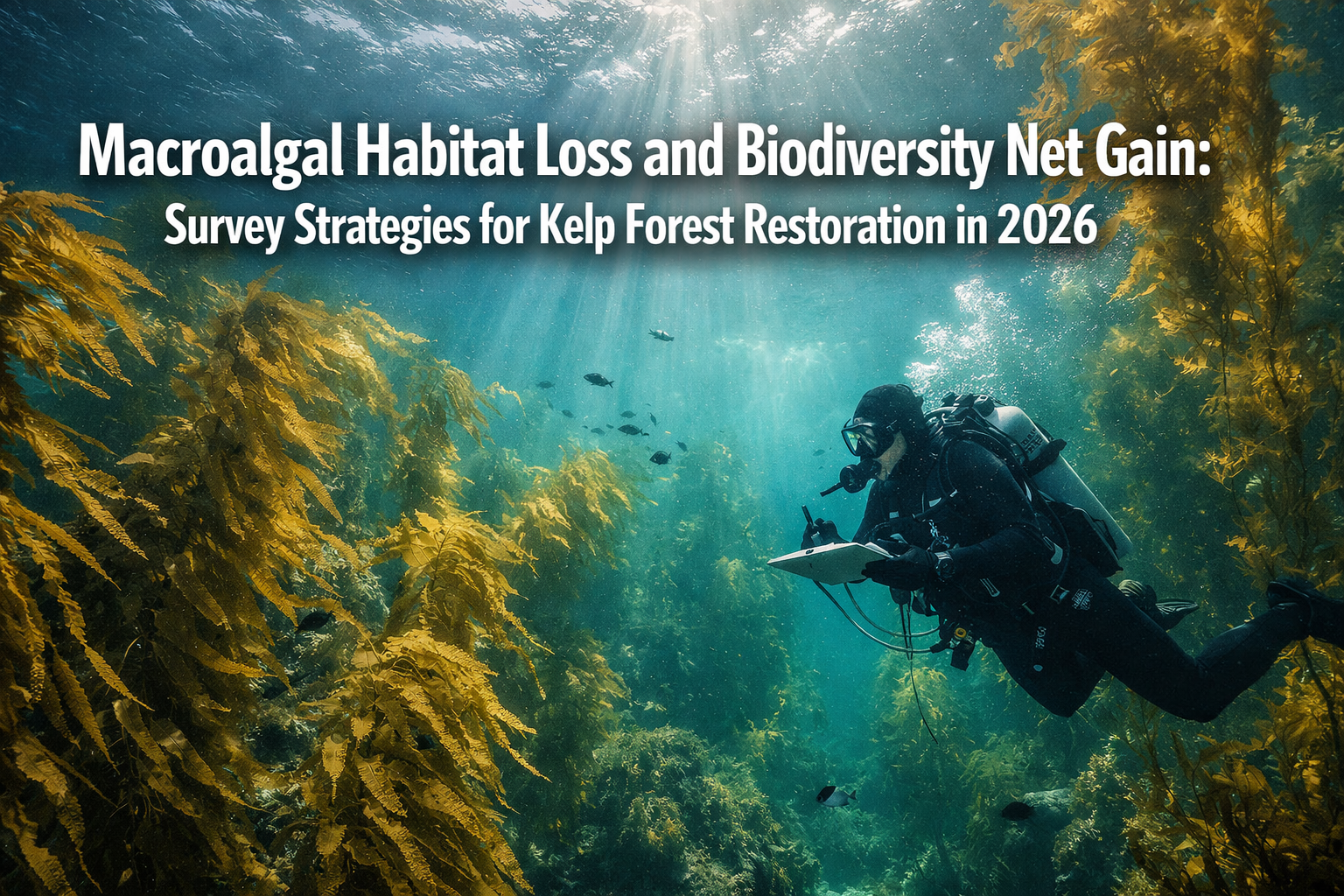
The ocean's underwater forests are disappearing at an alarming rate. Recent warnings from ecological horizon scans have highlighted seaweed habitat vulnerabilities to warming waters, creating an urgent need for targeted survey strategies that can quantify losses and support restoration efforts. As we navigate 2026, the intersection of macroalgal habitat loss and biodiversity net gain principles offers a powerful framework for kelp forest recovery—but only if restoration practitioners employ the right survey methodologies to establish baselines and track progress.
Macroalgal Habitat Loss and Biodiversity Net Gain: Survey Strategies for Kelp Forest Restoration in 2026 represents a critical evolution in marine conservation. With kelp forests declining by up to 90% in some regions since the 2014-2015 marine heatwave, ecologists and restoration practitioners must adopt evidence-based survey approaches that inform both passive and active restoration techniques while meeting emerging regulatory requirements for biodiversity accounting.
Key Takeaways
- Passive restoration dramatically outperforms active transplantation: Water quality improvements can yield kelp recovery approximately 386 times more effective than manual transplanting for large-scale expansion
- Drone technology revolutionizes monitoring: Unoccupied aerial systems (UAS) can now distinguish between kelp species, map sparse canopy, and track recovery near complex shorelines
- Biodiversity net gain principles apply to marine habitats: Survey strategies must quantify baseline conditions, measure losses, and demonstrate measurable gains in ecosystem services
- Location-specific approaches are essential: Different regions require tailored restoration strategies based on underlying drivers—from urchin barrens to seed bank depletion
- Multi-metric tracking ensures accountability: Successful restoration monitoring extends beyond area coverage to include carbon cycling, fisheries biomass, and socioeconomic benefits
Understanding Macroalgal Habitat Loss in 2026
The Scale of Kelp Forest Decline
Kelp forests—the towering underwater ecosystems dominated by large brown algae—face unprecedented threats in 2026. These macroalgal habitats provide critical ecosystem services including nursery grounds for commercial fish species, carbon sequestration, coastal protection, and biodiversity hotspots supporting hundreds of species.
The giant kelp forests of La Jolla and San Diego exemplify the severity of recent losses. Research by UC San Diego's Scripps Institution of Oceanography documents declines of up to 90% since the 2014-2015 marine heatwave, with forests remaining unrecovered despite normalized water temperatures.[3] This pattern repeats across temperate coastlines globally, from California to Tasmania to Norway.
Primary Drivers of Macroalgal Habitat Loss
Understanding the mechanisms behind kelp forest collapse is essential for designing effective survey strategies. The drivers vary significantly by location:
🌡️ Climate-Related Stressors
- Marine heatwaves causing thermal stress and mortality
- Ocean acidification affecting kelp physiology
- Changing ocean dynamics disrupting nutrient delivery
- Increased storm intensity physically removing kelp
🦔 Ecological Imbalances
- Urchin population explosions creating "urchin barrens"
- Loss of predators (sea otters, sunflower stars) that control herbivores
- Competitive invasive algae species
- Disease and pathogen outbreaks
💧 Water Quality Degradation
- Coastal pollution reducing light penetration
- Nutrient runoff altering community composition
- Sedimentation smothering recruitment substrate
- Wastewater discharge impacts
🌱 Recruitment Failure
- Depletion of local seed banks
- Loss of reproductive adults
- Unsuitable settlement conditions
- Lack of available substrate
The specific combination of stressors determines which restoration approach—and corresponding survey methodology—will prove most effective. This diagnostic phase represents the foundation of any biodiversity net gain assessment.
Survey Strategies for Establishing Restoration Baselines
Pre-Restoration Baseline Surveys
Before implementing any restoration intervention, practitioners must establish comprehensive baseline conditions. These surveys document the "before" state against which biodiversity gains will be measured—a fundamental requirement for demonstrating net gain outcomes.
Essential Baseline Metrics:
| Survey Component | Measurement Method | Frequency | Purpose |
|---|---|---|---|
| Kelp canopy cover | UAS drone mapping | Quarterly | Area extent quantification |
| Kelp density | Underwater transects | Bi-annually | Population structure |
| Species composition | Quadrat sampling | Annually | Biodiversity baseline |
| Water quality | Multi-parameter probes | Monthly | Environmental conditions |
| Herbivore populations | Visual surveys/traps | Quarterly | Grazing pressure assessment |
| Substrate availability | Benthic surveys | Once | Recruitment potential |
Establishing these baselines requires coordination across multiple survey techniques, each with specific protocols and quality control measures. The biodiversity net gain report framework provides valuable guidance for structuring marine habitat assessments, even though originally developed for terrestrial applications.
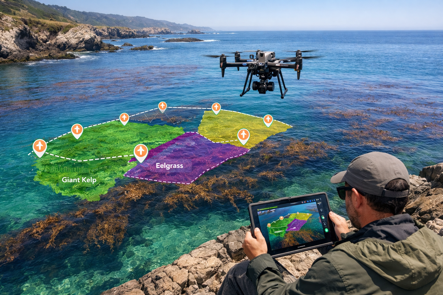
Unoccupied Aerial Systems (UAS) for Kelp Mapping
Drone technology has emerged as a game-changing tool for kelp forest surveys in 2026. The California Department of Fish and Wildlife, in partnership with The Nature Conservancy and Greater Farallones National Marine Sanctuary, has successfully demonstrated UAS capabilities for monitoring kelp canopy dynamics.[2]
Advantages of UAS Drone Surveys:
✅ Species discrimination: Advanced sensors can distinguish between giant kelp (Macrocystis pyrifera) and bull kelp (Nereocystis luetkeana)
✅ Complex shoreline access: Drones can map kelp close to rocky coastlines inaccessible to boats or satellites
✅ Sparse canopy detection: High-resolution imaging detects early-stage recovery and sparse patches missed by satellite imagery
✅ Cost-effectiveness: Covers larger areas more economically than diver surveys for canopy assessment
✅ Temporal flexibility: Rapid deployment allows surveys timed to specific tidal or seasonal conditions
The integration of UAS technology into standard monitoring protocols represents a significant advancement for tracking restoration progress at local scales while maintaining landscape-level context.
Underwater Survey Methodologies
While drones excel at canopy mapping, understanding kelp forest structure and associated biodiversity requires underwater survey techniques:
Diver-Based Transect Surveys
- SCUBA or freediving along fixed transect lines
- Kelp density counts by size class
- Fish and invertebrate abundance tallies
- Substrate characterization
- Photographic documentation
Remote Operated Vehicles (ROVs)
- Access to deeper kelp beds beyond diver limits
- Video transects for species identification
- Reduced weather dependency
- Permanent video records for verification
Baited Remote Underwater Video (BRUV)
- Standardized fish community assessments
- Non-extractive sampling
- Minimal diver bias
- Comparative data across sites
Reef Check has developed standardized protocols for kelp forest monitoring that ensure data consistency across regions and years, with 2026 training programs now open for volunteer citizen scientists.[6]

Comparing Passive and Active Restoration Approaches for Macroalgal Habitat Loss and Biodiversity Net Gain
The Passive Restoration Advantage
Recent research has revealed striking differences in restoration effectiveness between passive and active approaches. A comprehensive study comparing these methods found that passive restoration through water quality improvements over 10 years yielded 1.15 hectares of kelp recovery, while active transplanting of 1 m² kelp patches over 3 years yielded only 0.0008 hectares—making passive restoration approximately 386 times more effective for large-scale expansion.[1]
Passive Restoration Strategies:
🌊 Water Quality Improvements
- Wastewater treatment plant upgrades
- Stormwater management infrastructure
- Agricultural runoff reduction
- Sediment control measures
🦦 Predator Recovery
- Sea otter reintroduction programs
- Marine protected area establishment
- Sunflower star conservation
- Fishing regulation adjustments
🌿 Natural Recruitment Enhancement
- Substrate provision without transplanting
- Removal of competitive invasive species
- Protection of remaining kelp patches as seed sources
- Current pattern restoration
The multi-scale benefits of passive restoration extend beyond simple area coverage. By addressing underlying drivers of coastal degradation, passive approaches provide broader ecosystem benefits across seascape scales with increased scalability potential.[1] However, these methods require substantial initial investment and longer timeframes before visible results emerge.
Active Restoration Techniques
Despite lower long-term expansion rates, active restoration offers valuable advantages in specific contexts. California's kelp restoration efforts—active since at least the 1960s—now employ multiple complementary approaches:[2]
Active Intervention Methods:
🌱 Kelp Outplanting
- Laboratory-grown juvenile kelp transplanted to restoration sites
- Controlled genetic diversity
- Thermally-tolerant strain selection
- Immediate canopy establishment
🧬 Reproductive Material Transplantation
- Fertile frond attachment to substrate
- Spore slurry application
- Gametophyte seeding
- Genetic rescue of depleted populations
🪨 Substrate Provision
- Artificial reef deployment
- Rock placement in sandy areas
- Concrete structures for attachment
- Enhancement of natural recruitment surfaces
🦔 Urchin Removal
- Manual culling by divers
- Trap-based removal
- Quicklime application (controversial)
- Predator enhancement
The Bay Foundation's urchin culling methods at Palos Verdes have proven highly effective where urchin barrens are the primary problem. Their techniques are being tested at Tankers Reef (Monterey) and Casper Reef (Mendocino County), with results shared through a 2026 webinar series.[4]
Location-Specific Diagnostic Surveys
Choosing between passive and active approaches requires thorough diagnostic surveys to identify the primary limiting factors. Unlike regions where urchin barrens dominate, La Jolla's kelp loss stems from lack of seed banks and changing ocean dynamics, necessitating different restoration strategies.[3]
Diagnostic Survey Framework:
- Water Quality Assessment: Determine if pollution limits kelp growth
- Herbivore Pressure Evaluation: Quantify urchin and other grazer densities
- Recruitment Limitation Analysis: Test for seed bank depletion versus settlement failure
- Substrate Availability Survey: Assess suitable attachment surfaces
- Hydrodynamic Characterization: Measure current patterns and nutrient delivery
- Thermal Stress Monitoring: Document temperature extremes and duration
This diagnostic phase directly informs restoration strategy selection and survey intensity requirements for monitoring. The principles align closely with achieving biodiversity net gain without the risk by ensuring interventions address actual limiting factors rather than symptoms.
Biodiversity Net Gain Principles Applied to Kelp Forest Restoration
Adapting Terrestrial BNG Frameworks to Marine Habitats
While biodiversity net gain regulations in the UK primarily target terrestrial development, the underlying principles translate powerfully to marine restoration contexts. The core concept—leaving biodiversity in a measurably better state than before intervention—provides a rigorous framework for kelp forest restoration accountability.
Key BNG Principles for Marine Application:
📊 Quantifiable Metrics: Establish measurable units for kelp forest biodiversity (area, density, species richness, functional diversity)
📈 Demonstrable Gains: Show net improvement over baseline conditions with statistical confidence
⏱️ Temporal Accounting: Track gains over ecologically meaningful timeframes (typically 30 years for terrestrial BNG)
🎯 Additionality: Ensure restoration creates gains beyond what would occur naturally
🔄 Monitoring and Adaptive Management: Implement ongoing surveys to verify predicted gains materialize
The 10% biodiversity net gain target established for UK development provides a useful benchmark, though marine ecosystems may warrant different percentage targets based on restoration potential and baseline degradation severity.
Multi-Metric Tracking for Comprehensive Net Gain
The Kelp Forest Alliance recognizes that restoration progress extends beyond simple area metrics. Their ambitious targets—200,000 hectares restored and 1 million hectares protected by 2030—are tracked across multiple benefit categories:[5]
Ecosystem Service Metrics:
🐟 Fisheries Production
- Biomass of commercially valuable species
- Nursery function for juvenile fish
- Invertebrate populations (lobster, abalone, urchin)
- Trophic structure complexity
🌍 Carbon Cycling
- Standing kelp biomass carbon storage
- Dissolved organic carbon export
- Particulate organic carbon deposition
- Long-term sequestration in deep sediments
💼 Socioeconomic Benefits
- Job creation in restoration sector
- Recreational diving and tourism value
- Commercial fishing revenue
- Coastal protection services
🔬 Biodiversity Indicators
- Species richness (alpha diversity)
- Community composition (beta diversity)
- Functional diversity indices
- Rare or threatened species presence
This multi-metric approach aligns with comprehensive biodiversity net gain planning that considers diverse stakeholder values and ecosystem functions rather than single-dimensional habitat area calculations.
Survey Intensity and Statistical Power
Demonstrating biodiversity net gain requires survey designs with sufficient statistical power to detect meaningful changes. Underpowered monitoring programs waste resources while failing to provide confidence in restoration outcomes.
Survey Design Considerations:
Sample Size Calculations
- Determine replication needed to detect target effect sizes
- Account for natural variability in kelp forest metrics
- Balance statistical power against budget constraints
- Consider spatial and temporal pseudoreplication
Control and Reference Sites
- Establish unrestored comparison sites
- Select reference sites representing restoration targets
- Match environmental conditions across site types
- Monitor all site types with identical protocols
Before-After-Control-Impact (BACI) Designs
- Collect baseline data before restoration intervention
- Continue monitoring after restoration implementation
- Compare restored sites to controls over time
- Statistically separate restoration effects from natural variation
Adaptive Monitoring
- Adjust survey intensity based on initial results
- Focus resources on metrics showing change
- Increase temporal frequency during critical periods
- Reduce effort on stable, well-characterized parameters
These rigorous survey designs ensure that claims of biodiversity net gain withstand scientific scrutiny and provide accountability for restoration investments.
Emerging Technologies and Future Survey Innovations
Environmental DNA (eDNA) for Biodiversity Assessment
Environmental DNA sampling represents a revolutionary approach for assessing kelp forest biodiversity without exhaustive visual surveys. By collecting water samples and sequencing the genetic material shed by organisms, eDNA surveys can:
- Detect rare or cryptic species missed by visual surveys
- Assess fish communities without capture or observation
- Monitor for invasive species early in establishment
- Track temporal changes in community composition
- Reduce survey costs for species-rich assemblages
As eDNA reference libraries expand in 2026, this technology increasingly complements traditional survey methods for comprehensive biodiversity net gain assessments.
Machine Learning for Image Analysis
The volume of imagery collected by UAS drones and underwater cameras exceeds human capacity for manual analysis. Machine learning algorithms now automate:
- Kelp canopy delineation from drone imagery
- Species identification from underwater photos
- Fish counts and size estimation from video
- Substrate classification from benthic images
- Change detection across time series
These AI-assisted approaches increase survey efficiency while maintaining consistency and reducing observer bias—critical factors for long-term monitoring programs tracking biodiversity net gain.
Integrated Sensor Networks
Real-time environmental monitoring through sensor networks provides continuous data streams complementing periodic biological surveys:
- Oceanographic sensors: Temperature, salinity, dissolved oxygen, pH, nutrients
- Acoustic monitoring: Fish abundance, species presence, soundscape ecology
- Optical sensors: Turbidity, chlorophyll, light availability
- Current meters: Water movement patterns, nutrient delivery
These continuous datasets help explain biological survey results and provide early warning of conditions threatening restoration success.
Case Studies: Survey Strategies in Practice
La Jolla Kelp Forest Restoration Research
The ongoing research initiative in La Jolla demonstrates comprehensive survey integration for addressing location-specific drivers. The project's four research objectives require distinct survey approaches:[3]
- Measuring Kelp Forest Health: Baseline and ongoing monitoring using diver transects, UAS mapping, and water quality sensors
- Understanding Loss Mechanisms: Experimental studies testing hypotheses about seed bank depletion and ocean dynamics
- Field Testing Techniques: Controlled trials comparing outplanting methods with intensive monitoring of survival and growth
- Developing Thermally-Tolerant Strains: Laboratory experiments combined with field performance trials
This multi-faceted approach exemplifies how survey strategies must align with specific restoration hypotheses and adapt to local conditions rather than applying generic protocols.
California Statewide Kelp Monitoring
California's comprehensive kelp monitoring program demonstrates the power of coordinated survey efforts across large geographic scales. The program integrates:[2]
- Satellite imagery for statewide canopy trends
- UAS drone surveys for regional detail
- Diver-based community monitoring
- Partner agency collaboration
- Long-term dataset continuity (decades)
This hierarchical approach—from satellite to drone to diver scales—provides context for local restoration efforts within broader ecosystem trends, essential for attributing observed changes to restoration interventions versus natural fluctuations.
Implementing Survey Strategies: Practical Guidance
Survey Planning for Restoration Projects
Successful survey strategies begin with clear planning that aligns monitoring intensity with project objectives and budgets:
Step 1: Define Restoration Goals
- Specify target kelp forest condition (area, density, composition)
- Identify priority ecosystem services to enhance
- Establish timeline for achieving targets
- Determine acceptable confidence levels for success claims
Step 2: Select Appropriate Metrics
- Choose indicators responsive to restoration actions
- Balance comprehensiveness against cost
- Prioritize metrics with established protocols
- Consider stakeholder values and regulatory requirements
Step 3: Design Survey Protocols
- Determine survey methods for each metric
- Calculate required sample sizes
- Establish survey frequency and timing
- Develop quality control procedures
Step 4: Allocate Resources
- Estimate costs for each survey component
- Identify personnel and equipment needs
- Plan for long-term monitoring commitment
- Build in adaptive management flexibility
This structured approach ensures survey strategies support biodiversity net gain delivery through appropriate evidence collection.
Regulatory Considerations and Reporting
As biodiversity net gain frameworks expand globally, kelp forest restoration projects may increasingly face regulatory reporting requirements. Survey strategies should anticipate:
- Standardized Metrics: Use widely accepted indicators for cross-project comparison
- Transparent Methodologies: Document protocols in sufficient detail for replication
- Data Accessibility: Archive data in public repositories for verification
- Third-Party Verification: Design surveys to support independent auditing
- Long-Term Commitments: Plan for monitoring extending beyond project funding cycles
Understanding what planners need to know about biodiversity net gain helps restoration practitioners anticipate regulatory expectations and design compliant survey programs.
Collaborative Approaches and Citizen Science
Kelp forest restoration monitoring benefits enormously from collaborative survey efforts. Reef Check's volunteer monitoring programs demonstrate how trained citizen scientists can collect high-quality data across geographic scales impossible for professional researchers alone.[6]
Benefits of Collaborative Monitoring:
- 🤝 Expanded Spatial Coverage: More sites surveyed simultaneously
- 💰 Cost Efficiency: Volunteer effort reduces per-sample costs
- 📚 Community Engagement: Builds public support for restoration
- 🎓 Education: Trains next generation of marine conservationists
- 📊 Long-Term Sustainability: Community ownership ensures monitoring continuity
Successful citizen science programs require investment in training, standardized protocols, quality control, and data management—but yield returns far exceeding these costs through sustained engagement and data collection.
Conclusion
Macroalgal Habitat Loss and Biodiversity Net Gain: Survey Strategies for Kelp Forest Restoration in 2026 represents a critical intersection of marine conservation science, restoration practice, and emerging regulatory frameworks. As kelp forests face unprecedented threats from climate change and coastal degradation, the survey strategies employed to quantify losses and track restoration gains will determine whether ambitious recovery targets translate into measurable biodiversity improvements.
The evidence clearly demonstrates that passive restoration approaches, when feasible, deliver dramatically superior outcomes—up to 386 times more effective than active transplantation for large-scale kelp forest expansion. However, realizing these gains requires addressing underlying drivers through water quality improvements, predator recovery, and ecosystem-level interventions that demand comprehensive diagnostic surveys and long-term monitoring commitments.
Emerging technologies—from UAS drones to environmental DNA to machine learning—are revolutionizing our capacity to monitor kelp forest biodiversity at scales and resolutions previously impossible. These tools enable the rigorous quantification essential for demonstrating biodiversity net gain under increasingly demanding accountability frameworks.
Yet technology alone cannot ensure restoration success. Location-specific approaches informed by thorough diagnostic surveys remain essential, as the drivers of kelp forest loss vary dramatically across regions. What works in urchin-dominated Monterey differs fundamentally from seed-bank-depleted La Jolla, requiring tailored survey strategies matched to local conditions and restoration hypotheses.
Actionable Next Steps
For restoration practitioners, developers, and conservation organizations working toward kelp forest recovery in 2026:
-
Establish comprehensive baselines before restoration interventions using multi-scale survey approaches from satellite to underwater transects
-
Invest in diagnostic surveys to identify location-specific limiting factors rather than assuming generic restoration approaches will succeed
-
Integrate emerging technologies like UAS drones and eDNA while maintaining continuity with traditional methods for long-term dataset compatibility
-
Design monitoring programs with sufficient statistical power to demonstrate biodiversity net gain with confidence, following biodiversity net gain assessment principles
-
Collaborate across organizations to share survey data, standardize protocols, and leverage citizen science for expanded monitoring capacity
-
Plan for long-term commitments recognizing that kelp forest restoration operates on decadal timescales requiring sustained survey efforts
-
Track multiple benefit streams beyond simple area metrics, including fisheries production, carbon cycling, and socioeconomic values
The ambitious targets set by the Kelp Forest Alliance—200,000 hectares restored by 2030—are achievable only through rigorous survey strategies that inform evidence-based restoration decisions and demonstrate accountable biodiversity gains. As regulatory frameworks increasingly demand quantifiable environmental improvements, the survey methodologies established in 2026 will shape marine conservation practice for decades to come.
The underwater forests that support countless species, sequester carbon, protect coastlines, and sustain fishing communities depend on our capacity to measure what we're losing and verify what we're gaining. Through strategic surveys, targeted restoration, and unwavering commitment to biodiversity net gain principles, kelp forest recovery remains within reach.
References
[1] Dryad – https://datadryad.org/dataset/doi:10.5061/dryad.r7sqv9ssc
[2] Monitoring – https://wildlife.ca.gov/Conservation/Marine/Kelp/Monitoring
[3] Kelp Restoration Science Initiative – https://seatrees.org/pages/kelp-restoration-science-initiative
[4] Reef Checks 2026 Winter Webinar Series – https://www.reefcheck.org/reef-checks-2026-winter-webinar-series/
[5] kelpforestalliance – https://kelpforestalliance.com/kelp-forest-challenge/faq/
[6] 2026 Kelp Forest Monitoring Trainings Now Open Register Today – https://www.reefcheck.org/2026-kelp-forest-monitoring-trainings-now-open-register-today/
