
The future of biodiversity conservation is arriving faster than many anticipated. As surveyors and ecologists prepare biodiversity net gain assessments for development projects across England, a critical question emerges: are current methodologies equipped to address the emerging threats identified in the latest scientific horizon scanning? Integrating 2026 Horizon Scan Issues into Biodiversity Net Gain Frameworks: Surveyor Action Plans represents not just a technical challenge, but an essential evolution in how professionals approach ecological compliance and conservation outcomes.
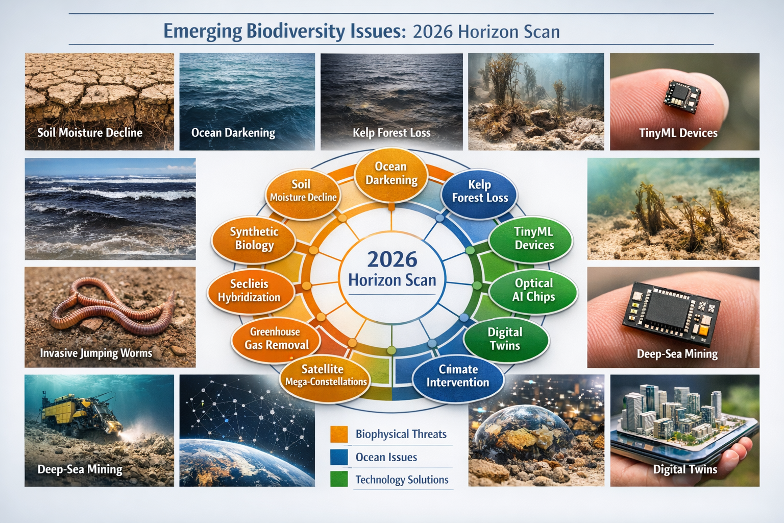
The 2026 Global Horizon Scan has identified 15 emerging issues that will shape biodiversity conservation over the next decade. From soil moisture decline threatening terrestrial ecosystems to ocean darkening affecting marine habitats, these scientifically-validated concerns demand immediate attention from practitioners working within Biodiversity Net Gain (BNG) frameworks. This comprehensive guide translates cutting-edge conservation science into practical surveyor checklists, helping professionals future-proof their assessments while maintaining regulatory compliance.
Key Takeaways
- 🔍 15 priority emerging issues identified by 26 international experts provide a roadmap for updating BNG assessment protocols in 2026
- 📊 Biophysical threats including soil moisture decline, ocean darkening, and kelp forest loss require new monitoring parameters in baseline surveys
- 💡 Technology solutions like TinyML devices and optical AI chips offer surveyors enhanced detection capabilities for remote and challenging landscapes
- ✅ Tailored surveyor checklists can integrate horizon scan findings into existing BNG workflows without disrupting compliance timelines
- 🌍 Proactive integration of emerging threats strengthens long-term biodiversity outcomes and positions projects ahead of future regulatory updates
Understanding the 2026 Horizon Scan: Scientific Foundation for Updated BNG Protocols
The 2026 Global Horizon Scan represents the 17th year of this critical conservation exercise, published in the prestigious journal Trends in Ecology & Evolution. This isn't speculative forecasting—it's a rigorous, evidence-based identification of emerging issues that will impact biodiversity conservation worldwide.
The Methodology Behind the Science
A multi-disciplinary panel of 26 scientists, practitioners, and policymakers conducted this comprehensive assessment through a structured process:
- Initial identification: 96 potential emerging issues were nominated
- Expert scoring: Panel members evaluated each issue based on scientific evidence and potential impact
- Workshop refinement: The 35 highest-ranked issues underwent intensive discussion
- Final prioritization: 15 top-ranked issues were selected for immediate attention
This rigorous methodology ensures that the identified issues represent genuine emerging threats rather than established concerns already addressed in current conservation frameworks.
Why Horizon Scanning Matters for BNG Compliance
Biodiversity Net Gain frameworks currently operate within well-established parameters, focusing on habitat types, species presence, and measurable biodiversity units. However, these frameworks were designed around known threats and established ecological baselines. The 2026 Horizon Scan reveals that:
- Emerging biophysical changes may alter habitat condition trajectories faster than 30-year management plans anticipate
- New technologies offer unprecedented monitoring capabilities that could enhance evidence quality
- Novel threats from human activities require assessment parameters not yet incorporated into standard survey protocols
For surveyors conducting biodiversity impact assessments, integrating these emerging issues isn't optional—it's essential for delivering robust, future-proof conservation outcomes.
The 15 Priority Issues: Implications for Biodiversity Surveyors
Integrating 2026 Horizon Scan Issues into Biodiversity Net Gain Frameworks: Surveyor Action Plans requires understanding each identified threat and its practical implications for field assessments. Let's examine the key issues most relevant to UK-based BNG work.
Biophysical Changes Affecting Baseline Assessments
Soil Moisture Decline
The Issue: Declining soil moisture across terrestrial and freshwater ecosystems threatens habitat condition and species viability.
Surveyor Implications:
- Baseline soil moisture measurements should be incorporated into habitat condition assessments
- Long-term monitoring plans must account for potential moisture regime shifts
- Wetland and riparian habitat valuations may require adjusted condition scoring
- Enhancement strategies should prioritize water retention features
Action Items:
✅ Include soil moisture sampling in Phase 1 habitat surveys
✅ Document drainage patterns and water retention characteristics
✅ Flag moisture-dependent habitats for enhanced monitoring protocols
✅ Recommend nature-based solutions that improve water infiltration
Ocean Darkening and Kelp Forest Loss
The Issue: Declining light penetration in ocean regions and projected loss of macroalgal habitats including kelp forests represent critical marine biodiversity threats.
Surveyor Implications:
- Coastal and marine BNG assessments must consider light availability metrics
- Kelp forest habitats require enhanced baseline documentation
- Intertidal zone assessments should include water clarity measurements
- Off-site biodiversity delivery strategies may need marine habitat banking options
Action Items:
✅ Incorporate water turbidity measurements in coastal surveys
✅ Document existing macroalgal communities with photographic evidence
✅ Assess coastal development impacts on light penetration
✅ Identify opportunities for kelp restoration in enhancement plans
Technology-Enabled Detection and Monitoring
Tiny Machine Learning (TinyML) Devices
The Issue: Miniaturized AI-powered sensors enable real-time biodiversity detection in remote landscapes, strengthening conservation evidence bases.
Surveyor Implications:
- Remote monitoring capabilities can supplement traditional survey methods
- Long-term monitoring requirements for BNG can be automated cost-effectively
- Species detection in challenging habitats becomes more feasible
- Data quality and verification protocols need updating for AI-generated evidence
Action Items:
✅ Evaluate TinyML deployment for 30-year monitoring commitments
✅ Develop protocols for validating AI-detected species records
✅ Include automated monitoring options in management plan costings
✅ Train staff on emerging detection technology capabilities
Optical AI Chips for Biodiversity Detection
The Issue: Advanced optical processing enables sophisticated real-time species identification and habitat analysis.
Surveyor Implications:
- Survey efficiency can be dramatically improved through automated identification
- Rare species detection rates may increase with AI-assisted analysis
- Photographic evidence can be processed more systematically
- Quality assurance protocols must adapt to AI-assisted workflows
Action Items:
✅ Pilot AI-assisted photo identification in standard survey protocols
✅ Establish verification procedures for AI-generated species lists
✅ Document technology use in methodology statements
✅ Consider AI tools for analyzing historical site imagery
Additional Emerging Issues Relevant to BNG
The remaining horizon scan issues include:
| Issue | BNG Relevance | Surveyor Consideration |
|---|---|---|
| Digital Twins | Virtual ecosystem modeling | Enhanced visualization for stakeholder engagement |
| Fibre Optic Drone Cables | Novel infrastructure impacts | New disturbance vectors in aerial surveys |
| Deep-Sea Mining | Marine habitat destruction | Coastal assessment context and cumulative impacts |
| Soil Inoculation | Enhancement technique efficacy | Evidence requirements for restoration claims |
| Southern Ocean Changes | Global biodiversity context | Climate change baseline adjustments |
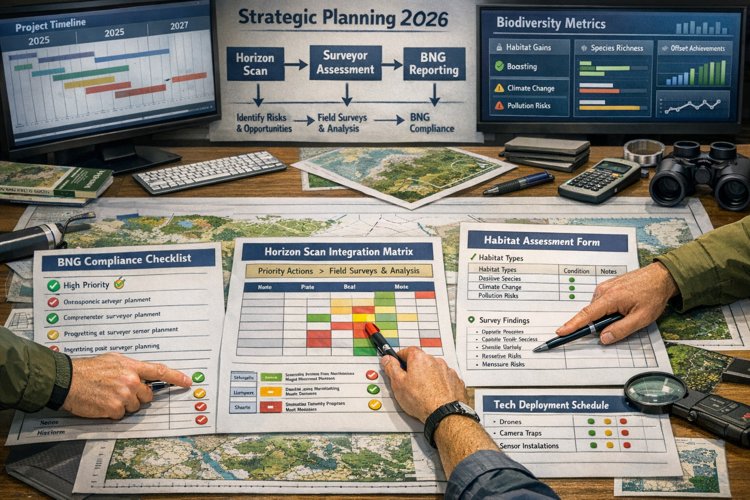
Practical Integration: Surveyor Checklists for Integrating 2026 Horizon Scan Issues into BNG Frameworks
Translating scientific findings into operational protocols requires systematic integration rather than wholesale methodology changes. The following checklists enable surveyors to incorporate emerging issues into existing BNG assessment workflows.
Pre-Survey Planning Checklist
Before conducting field assessments, surveyors should:
🔲 Review site context for emerging threat exposure
- Identify which of the 15 horizon scan issues are relevant to site location and habitat types
- Assess coastal proximity for ocean darkening considerations
- Evaluate soil type and hydrology for moisture decline vulnerability
- Determine technology deployment opportunities for remote/challenging areas
🔲 Update equipment and methodology
- Include soil moisture measurement tools in field kit
- Prepare water clarity assessment equipment for coastal sites
- Configure camera systems for AI-assisted identification
- Ensure GPS accuracy for long-term monitoring point establishment
🔲 Adjust survey scope and timing
- Allocate additional time for emerging threat parameter collection
- Schedule surveys to capture seasonal moisture variations
- Plan for technology calibration and validation procedures
- Coordinate with specialists for novel assessment requirements
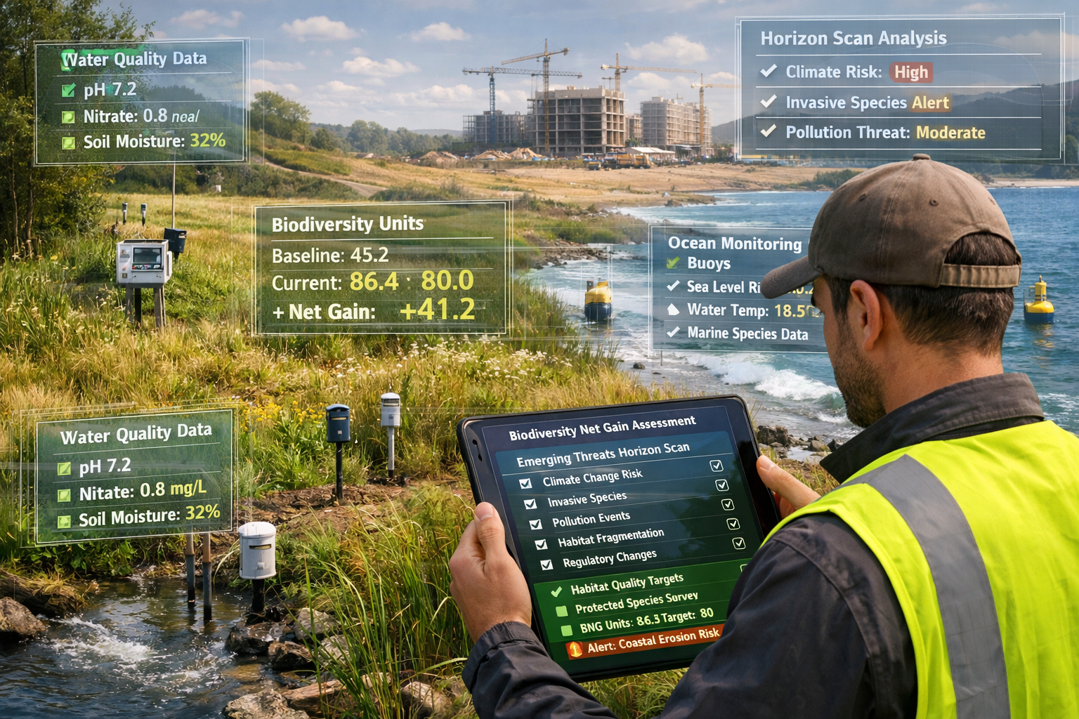
Field Assessment Integration Checklist
During site surveys, incorporate these additional parameters:
Terrestrial Habitats:
- ✅ Soil moisture readings at representative locations
- ✅ Photographic documentation of soil structure and organic matter
- ✅ Water feature mapping including ephemeral streams
- ✅ Drainage pattern observation and documentation
- ✅ Vegetation stress indicators related to moisture availability
Coastal and Marine Habitats:
- ✅ Water clarity measurements using Secchi disk or turbidity meter
- ✅ Macroalgal community composition and health assessment
- ✅ Intertidal zone light availability observations
- ✅ Substrate composition affecting light penetration
- ✅ Evidence of coastal erosion or sedimentation changes
Technology-Enhanced Monitoring:
- ✅ Deployment locations identified for TinyML devices
- ✅ Photographic datasets collected for AI processing
- ✅ Acoustic monitoring point establishment
- ✅ Remote sensing validation ground-truthing
- ✅ Technology access and maintenance route planning
Reporting and Compliance Documentation
When preparing biodiversity net gain reports, include:
Enhanced Baseline Documentation:
- Emerging threat parameter measurements and methodology
- Horizon scan issue relevance assessment for the site
- Baseline vulnerability scoring for identified threats
- Technology-assisted detection results and validation
Updated Metric Calculations:
- Condition score adjustments reflecting emerging threat exposure
- Risk multipliers for habitats vulnerable to identified issues
- Enhanced monitoring requirements for high-risk areas
- Technology-enabled monitoring cost-benefit analysis
Future-Proofed Management Plans:
- Adaptive management triggers linked to emerging threat indicators
- Technology deployment schedules for long-term monitoring
- Climate resilience measures addressing moisture and temperature shifts
- Stakeholder communication protocols for novel monitoring approaches
Strategic Action Plans for Different Project Types
Integrating 2026 Horizon Scan Issues into Biodiversity Net Gain Frameworks: Surveyor Action Plans must be tailored to project scale, location, and habitat complexity.
Small Development Projects
For small development projects, focus on:
Priority Integration Points:
- Simplified threat screening – Quick assessment of which horizon scan issues apply
- Proportionate parameter collection – Focus on 2-3 most relevant emerging threats
- Technology cost-benefit – Evaluate if AI tools reduce overall survey costs
- Standard template updates – Incorporate emerging issue checkboxes into routine assessments
Recommended Approach:
- Add soil moisture spot-checks to standard habitat surveys
- Use smartphone apps with AI identification for efficiency gains
- Document any unusual environmental conditions that align with horizon scan issues
- Include brief emerging threat commentary in baseline reports
Large-Scale Developments
Major projects require comprehensive integration:
Enhanced Assessment Framework:
- Full horizon scan review – Systematic evaluation of all 15 issues
- Specialist input – Engage experts for novel threat assessment
- Technology deployment – Invest in TinyML and AI monitoring infrastructure
- Adaptive management – Build flexibility into 30-year plans
Recommended Approach:
- Commission specialist studies for high-priority emerging threats
- Establish automated monitoring networks from project outset
- Create digital twin models for stakeholder visualization
- Develop research partnerships to validate novel assessment methods
Coastal and Marine Developments
Projects affecting marine environments demand particular attention:
Marine-Specific Protocols:
- Ocean darkening assessment – Mandatory water clarity baseline and monitoring
- Macroalgal habitat prioritization – Enhanced kelp forest protection measures
- Cumulative impact consideration – Deep-sea mining and coastal development interactions
- Marine technology deployment – Underwater AI detection systems
Recommended Approach:
- Partner with marine specialists familiar with emerging ocean threats
- Establish underwater monitoring stations with optical sensors
- Document baseline light penetration across depth gradients
- Design enhancement measures that improve water clarity
Achieving Biodiversity Net Gain While Addressing Emerging Threats
The ultimate goal isn't just compliance—it's delivering measurable biodiversity improvements that remain robust against emerging threats. Achieving biodiversity net gain without risk requires proactive integration of horizon scan findings.
Enhancement Design Principles
Climate-Resilient Habitat Creation:
- Design wetlands with variable depth profiles to accommodate moisture fluctuations
- Select plant species tolerant of both drought and waterlogging
- Incorporate water retention features like swales and rain gardens
- Create microhabitat diversity to provide refugia during environmental shifts
Technology-Enhanced Management:
- Install TinyML monitoring networks to track enhancement success
- Use AI-assisted analysis to detect early warning signs of degradation
- Implement automated irrigation triggers based on soil moisture sensors
- Deploy optical detection systems for rare species colonization monitoring
Future-Proof Habitat Banking:
- Prioritize habitat banking locations less vulnerable to emerging threats
- Include emerging threat resilience in site selection criteria
- Design enhancement schemes that address multiple horizon scan issues
- Establish monitoring protocols that capture emerging threat indicators
Stakeholder Communication Strategies
Explaining horizon scan integration to clients and planning authorities requires clear messaging:
Key Communication Points:
- Emerging threats represent scientifically-validated risks to long-term biodiversity outcomes
- Proactive integration protects investment in enhancement measures
- Technology deployment reduces long-term monitoring costs while improving data quality
- Future-proofing assessments positions projects ahead of regulatory evolution
Recommended Messaging:
"By integrating the latest scientific findings on emerging biodiversity threats, this assessment ensures that enhancement measures will deliver robust conservation outcomes throughout the 30-year management period, even as environmental conditions evolve."
Professional Development and Training Priorities
Surveyors must develop new competencies to effectively integrate horizon scan issues:
Essential Skills for 2026 and Beyond
Technical Capabilities:
- Soil moisture measurement and interpretation
- Water quality parameter collection and analysis
- Technology deployment and data management
- AI-assisted identification tool proficiency
- Digital twin modeling and visualization
Analytical Competencies:
- Emerging threat vulnerability assessment
- Climate change scenario planning
- Adaptive management framework design
- Technology cost-benefit analysis
- Long-term monitoring program optimization
Professional Knowledge:
- Current horizon scanning literature review
- International conservation trend awareness
- Regulatory evolution anticipation
- Novel assessment methodology evaluation
- Cross-disciplinary collaboration skills
Continuing Professional Development Recommendations
Immediate Actions:
- Review the full 2026 Horizon Scan publication
- Attend webinars on emerging conservation technologies
- Pilot TinyML or AI tools on upcoming projects
- Join professional networks discussing methodology innovation
- Develop case studies demonstrating horizon scan integration
Long-term Investment:
- Pursue specialist training in climate-resilient habitat design
- Obtain certifications in emerging monitoring technologies
- Contribute to industry guidance development
- Publish case studies and methodology papers
- Mentor junior surveyors in future-proof assessment approaches
Regulatory Context and Future Outlook
While current BNG regulations don't explicitly require horizon scan integration, several trends suggest this will become increasingly important:
Emerging Regulatory Signals
Policy Evolution Indicators:
- Government biodiversity strategies increasingly reference climate adaptation
- Planning authorities requesting enhanced resilience evidence
- Statutory biodiversity credit pricing may reflect long-term risk
- Professional bodies updating guidance to incorporate emerging science
Proactive Compliance Benefits:
- Reduced risk of future assessment challenges
- Stronger evidence base for planning applications
- Enhanced professional reputation and competitive advantage
- Better alignment with government BNG consultation outcomes
International Context
The UK's BNG framework operates within a global conservation landscape:
Global Drivers:
- UNEP-WCMC's "Nature for Development" initiative aligns with horizon scan priorities
- International biodiversity frameworks increasingly emphasize emerging threats
- Scientific consensus on climate-biodiversity interactions strengthens
- Technology adoption accelerates across conservation sectors worldwide
UK Leadership Opportunity:
- Early integration positions UK practice as international exemplar
- Methodology innovation can be exported to other jurisdictions
- Professional expertise development creates competitive advantage
- Research partnerships enhance evidence base for policy development
Conclusion: Building Future-Proof Biodiversity Net Gain Assessments
Integrating 2026 Horizon Scan Issues into Biodiversity Net Gain Frameworks: Surveyor Action Plans represents a critical evolution in professional ecological practice. The 15 emerging issues identified through rigorous scientific analysis aren't distant theoretical concerns—they're immediate realities that will shape biodiversity outcomes for projects beginning in 2026 and beyond.
Surveyors who proactively incorporate these findings into their assessment methodologies will deliver superior conservation outcomes while positioning themselves at the forefront of professional practice. The integration process needn't be overwhelming: start with the most relevant issues for your typical project types, pilot technology solutions on appropriate sites, and gradually expand your capability as experience grows.
Your Next Steps
Immediate Actions (This Week):
- Review the 15 horizon scan issues and identify the top 3 most relevant to your practice area
- Update your standard survey templates to include emerging threat screening questions
- Research available TinyML or AI identification tools suitable for your typical projects
- Discuss horizon scan integration with colleagues and identify knowledge gaps
Short-term Goals (This Month):
- Pilot enhanced assessment parameters on an upcoming project
- Develop client communication materials explaining horizon scan integration benefits
- Attend professional development training on emerging monitoring technologies
- Create case study documentation of your integration approach
Long-term Strategy (This Year):
- Establish technology partnerships for advanced monitoring capabilities
- Contribute to industry guidance development on emerging threat integration
- Build specialist expertise in 2-3 priority horizon scan issues
- Position your practice as a leader in future-proof BNG assessments
The biodiversity challenges of 2026 and beyond demand more than business-as-usual approaches. By integrating cutting-edge conservation science into practical surveyor workflows, professionals can ensure that biodiversity net gain frameworks deliver lasting conservation value in an era of rapid environmental change.
For comprehensive support in developing your horizon scan integration strategy, explore our guidance for developers and discover how achieving 10% biodiversity net gain can incorporate emerging threat resilience from the outset.
