
Where land meets sea, biodiversity doesn't stop at arbitrary boundaries—yet most assessment protocols still do. A recent 2026 Global Horizon Scan identified the projected loss of macroalgal habitats, including kelp forests, as a critical vulnerability in coastal ecosystems facing warming and extreme events.[4] This emerging threat underscores why Coastal Ecosystem Surveys for Biodiversity Net Gain: Integrating Land-Sea Interactions in 2026 Baseline Assessments must evolve beyond traditional terrestrial-only approaches to capture the full ecological complexity of transition zones.
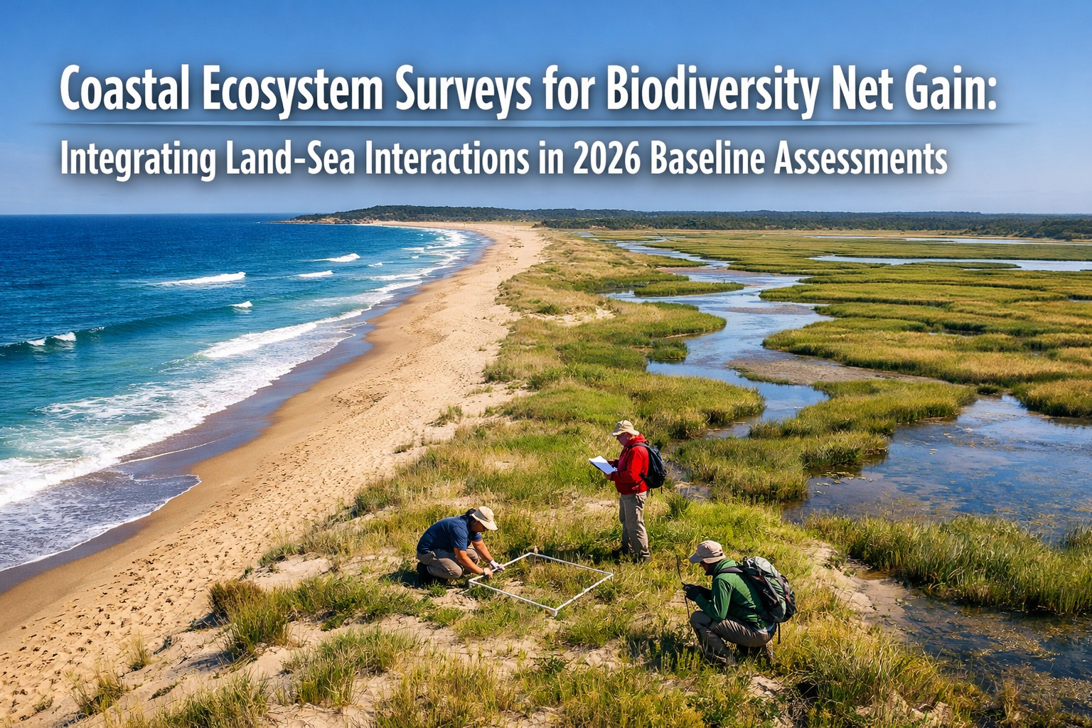
Coastal ecosystems represent some of Earth's most connected and dynamic environments, where terrestrial habitats like saltmarsh and coastal grasslands seamlessly transition into marine environments including seagrass meadows, kelp forests, and intertidal zones. For ecologists designing comprehensive biodiversity surveys that meet Biodiversity Net Gain (BNG) requirements, these land-sea interfaces present unique challenges—and unprecedented opportunities for holistic conservation.
As Marine Biodiversity Net Gain remains "at the very forefront of its journey" with government responses confirming support while acknowledging that "more work is needed in the delivery and metric,"[1] practitioners conducting Coastal Ecosystem Surveys for Biodiversity Net Gain: Integrating Land-Sea Interactions in 2026 Baseline Assessments find themselves pioneering methodologies that will shape conservation practice for decades to come.
Key Takeaways
✅ Integrated approach essential: Coastal baseline assessments must capture both terrestrial and marine habitats to reflect true ecological connectivity and avoid undervaluing transition zone biodiversity.
✅ Expanded methodologies required: Marine baseline surveys incorporate benthic sampling, acoustic surveys, and remote sensing techniques beyond traditional terrestrial field survey methods.[1]
✅ Priority habitats identified: Seabed sands and muds, reefs, seagrass meadows, kelp forests, saltmarsh, intertidal flats, and estuaries require specialized integrated assessment protocols.[1]
✅ Regulatory framework developing: While terrestrial BNG became mandatory in 2024 with the 10% biodiversity net gain requirement, Marine Net Gain implementation continues to evolve with adaptive management frameworks.[3]
✅ Blue carbon integration emerging: Coastal ecosystem assessments increasingly incorporate carbon sequestration potential alongside biodiversity metrics, creating dual-benefit restoration opportunities.[2]
Understanding Coastal Ecosystem Complexity in 2026 BNG Frameworks
The fundamental challenge of Coastal Ecosystem Surveys for Biodiversity Net Gain: Integrating Land-Sea Interactions in 2026 Baseline Assessments lies in recognizing that coastal zones function as integrated ecological systems rather than separate terrestrial and marine compartments. Traditional survey approaches that treat the shoreline as a hard boundary fail to capture critical ecological processes.
Why Land-Sea Integration Matters for Baseline Assessments
Coastal ecosystems demonstrate remarkable ecological connectivity across the land-sea interface:
🌊 Nutrient cycling: Terrestrial runoff influences marine productivity while tidal action delivers marine-derived nutrients to coastal vegetation
🐦 Species movement: Migratory birds, fish, and invertebrates depend on both terrestrial and marine habitats during different life stages
🌱 Habitat interdependence: Saltmarsh vegetation stabilizes sediments that support adjacent seagrass beds, while kelp forests buffer wave energy protecting coastal habitats
💧 Hydrological connections: Freshwater inputs, tidal regimes, and groundwater discharge create gradient zones supporting specialized biodiversity
When conducting biodiversity impact assessments, failing to account for these connections produces artificially low baseline biodiversity unit calculations that undervalue coastal development sites and may lead to inadequate compensation measures.
Regulatory Context for Coastal BNG in 2026
The Environment Act 2021 established mandatory BNG for terrestrial developments, with implementation beginning in February 2024 for major sites and April 2024 for small sites.[3] However, Marine Net Gain follows a different trajectory:
| Aspect | Terrestrial BNG | Marine Net Gain |
|---|---|---|
| Mandatory status | Required since 2024 | Under development |
| Metric availability | Statutory metric operational | Additional work needed[1] |
| Habitat classification | UKHab standardized | Expanding methodologies |
| Boundary approach | Fixed site boundaries | Adaptive management frameworks[1] |
| Assessment protocols | Well-established | Pioneering phase |
This regulatory gap creates both challenges and opportunities for practitioners conducting coastal surveys. Projects affecting transition zones must navigate evolving guidance while establishing robust baseline data that withstands scrutiny as Marine Net Gain frameworks mature.
Methodologies for Coastal Ecosystem Surveys for Biodiversity Net Gain: Integrating Land-Sea Interactions in 2026 Baseline Assessments
Comprehensive coastal baseline assessments require integrated survey methodologies that combine terrestrial and marine techniques while addressing the unique characteristics of transition habitats.
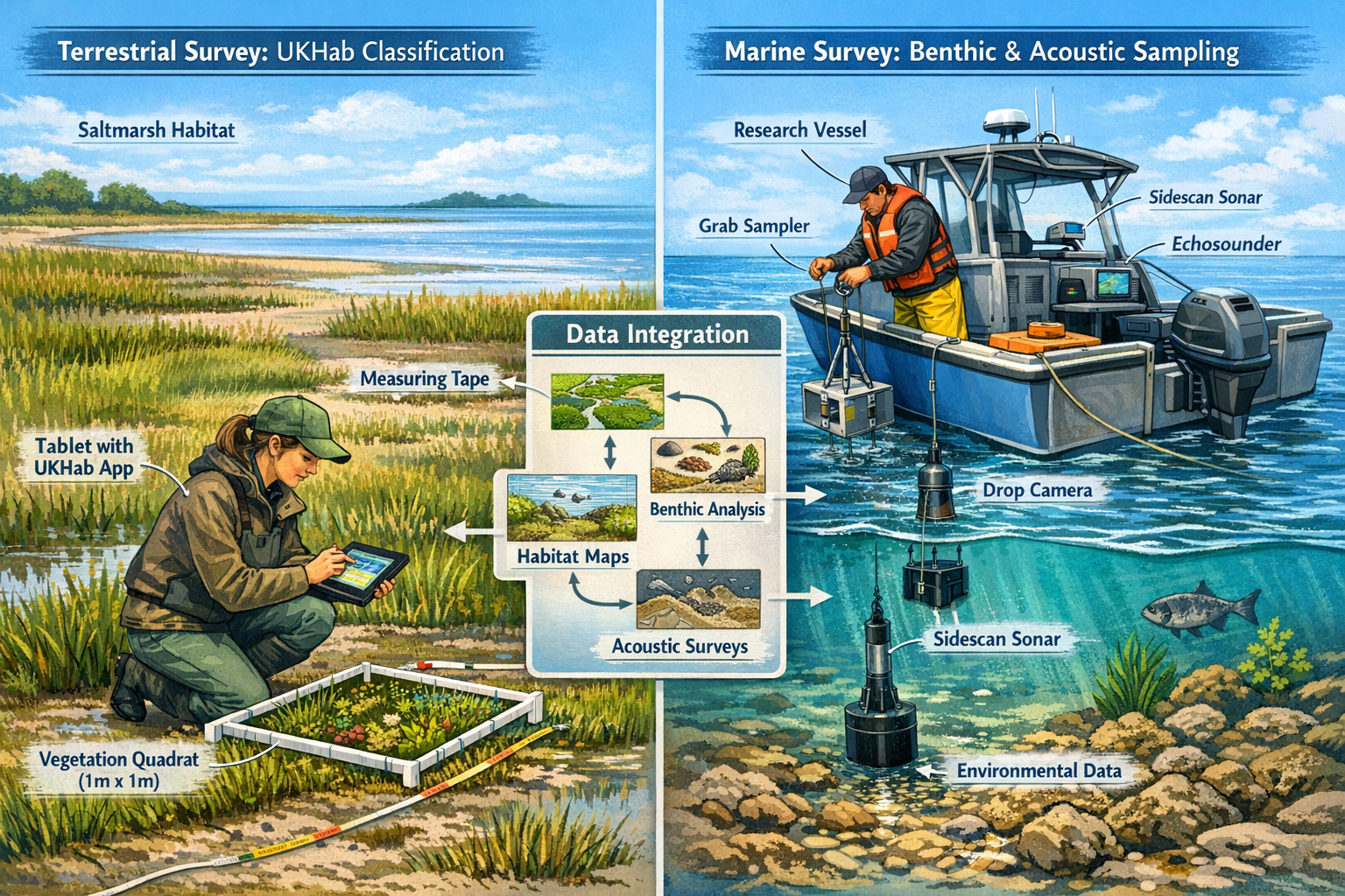
Terrestrial Component: Established BNG Survey Protocols
The terrestrial portion of coastal surveys follows standardized protocols outlined in biodiversity net gain assessments:
Habitat mapping and classification:
- Apply UKHab classification system to identify and map all terrestrial habitat types
- Record habitat extent (area in hectares) with GPS-enabled survey equipment
- Document habitat boundaries with particular attention to transition zones
- Photograph representative areas for condition assessment verification
Condition assessment:
- Evaluate each habitat parcel against statutory condition criteria
- Assign condition categories: good, moderate, or poor
- Record condition justifications with photographic evidence
- Note any features indicating connectivity with adjacent marine habitats
Baseline biodiversity unit calculation:
- Input habitat data into statutory biodiversity metric
- Calculate habitat units based on distinctiveness, condition, and strategic significance
- Document hedgerow and river units where applicable
- Generate pre-development baseline for impact assessment
Marine Component: Expanding Assessment Techniques
Marine baseline surveys for coastal sites incorporate specialized methodologies that differ significantly from terrestrial approaches:[1]
Benthic sampling:
- Deploy grab samplers or cores to collect seabed substrate samples
- Identify and quantify invertebrate communities
- Assess sediment characteristics and organic content
- Evaluate habitat quality indicators
Acoustic surveys:
- Use side-scan sonar to map seabed topography and habitat structure
- Deploy multibeam echosounders for detailed bathymetric data
- Identify reef structures, seagrass beds, and other priority habitats
- Create spatial distribution maps of marine habitat types
Remote sensing techniques:
- Analyze satellite imagery for large-scale habitat mapping
- Deploy underwater cameras and ROVs (remotely operated vehicles)
- Use drone technology for shallow water and intertidal zone surveys
- Integrate aerial photography with underwater data
Water quality assessment:
- Measure salinity, temperature, dissolved oxygen, and turbidity
- Assess nutrient levels and potential pollution indicators
- Evaluate factors affecting habitat condition
- Document seasonal variations affecting baseline conditions
Transition Zone Protocols: The Critical Interface
The land-sea transition zone requires specialized survey approaches that capture dynamic processes:
Intertidal surveys:
- Conduct surveys at multiple tidal stages to document full habitat extent
- Map zonation patterns of vegetation and invertebrate communities
- Assess substrate stability and erosion/accretion patterns
- Document tidal range and flood frequency
Saltmarsh assessment:
- Apply both terrestrial vegetation survey methods and marine sediment analysis
- Evaluate vegetation community composition and structure
- Assess creek networks and hydrological connectivity
- Document carbon sequestration potential for blue carbon integration[2]
Estuarine characterization:
- Survey both freshwater and marine influences on habitat composition
- Document salinity gradients and mixing zones
- Assess fish nursery functions and migratory species use
- Evaluate sediment transport and deposition patterns
Priority Coastal Habitats Requiring Integrated Assessment
Coastal Ecosystem Surveys for Biodiversity Net Gain: Integrating Land-Sea Interactions in 2026 Baseline Assessments must prioritize habitats that demonstrate significant land-sea connectivity and support high biodiversity value.
Marine Priority Habitats
The following marine habitats require specialized baseline assessment protocols:[1]
Seabed sands and muds:
- Support diverse invertebrate communities
- Provide feeding grounds for fish and wading birds
- Serve as nursery areas for commercially important species
- Require benthic sampling and acoustic survey techniques
Reef structures:
- Include natural rock reefs and biogenic reefs (oyster, mussel)
- Support exceptional biodiversity and structural complexity
- Provide coastal protection functions
- EU-funded oyster reef restoration projects demonstrate practical integration of land-based facilities with marine habitat creation[2]
Seagrass meadows:
- Function as critical carbon sinks and oxygen producers
- Provide nursery habitat for fish species
- Stabilize sediments and improve water quality
- Require underwater surveys and remote sensing assessment
Kelp forests:
- Support complex food webs and high biodiversity
- Face increasing vulnerability to warming and extreme events[4]
- Provide coastal protection and carbon sequestration
- Require underwater visual surveys and acoustic mapping
Terrestrial-Marine Transition Habitats
Saltmarsh ecosystems:
- Bridge terrestrial and marine environments
- Provide exceptional carbon sequestration (blue carbon)
- Support migratory bird populations
- Buffer coastal areas from storm surge and erosion
- The European Commission supports Member States in planning restoration measures to cover at least 20% of EU sea areas with necessary measures by 2030[2]
Intertidal flats:
- Support internationally important wading bird populations
- Provide feeding areas for fish during tidal inundation
- Demonstrate clear connectivity between terrestrial and marine food webs
- Require surveys at multiple tidal stages
Estuarine habitats:
- Function as transition zones between freshwater and marine systems
- Support migratory fish species including salmon and eels
- Provide nursery grounds for marine fish species
- Require integrated freshwater and marine assessment approaches
Emerging Concerns: Macroalgal Habitat Loss
The 2026 Global Horizon Scan identifies projected loss of macroalgal habitats—including kelp forests and other seaweed communities—as a significant emerging concern.[4] These ecosystems face multiple threats:
⚠️ Ocean warming: Temperature increases exceed tolerance ranges for many macroalgal species
⚠️ Extreme events: Storms and heatwaves cause mass mortality events
⚠️ Herbivore outbreaks: Warming waters enable sea urchin population explosions that overgraze kelp
⚠️ Reduced water quality: Increased turbidity from coastal development reduces light penetration
Baseline assessments conducted in 2026 must document macroalgal habitat extent, condition, and vulnerability factors to inform appropriate compensation and enhancement measures.
Implementing Adaptive Management Frameworks for Coastal BNG
Rather than rigid, static boundary designations, marine environments require adaptive management frameworks that accommodate dynamic coastal processes.[1] This approach represents a fundamental shift from traditional terrestrial BNG protocols.
Key Principles of Adaptive Coastal Assessment
Temporal variability:
- Conduct surveys across multiple seasons to capture seasonal biodiversity patterns
- Document storm impacts and recovery trajectories
- Account for inter-annual variability in habitat extent and condition
- Establish monitoring protocols that detect long-term trends
Spatial flexibility:
- Define assessment areas based on ecological boundaries rather than administrative lines
- Account for habitat migration due to sea-level rise and coastal squeeze
- Incorporate buffer zones that accommodate natural variability
- Consider connectivity with adjacent coastal sites
Process-based approach:
- Prioritize maintaining ecological processes over fixed habitat locations
- Assess sediment transport, nutrient cycling, and hydrological connectivity
- Evaluate habitat-forming species and ecosystem engineers
- Consider climate adaptation and resilience factors
Integration with Blue Carbon Initiatives
The EU is actively working to define methodologies for certifying carbon farming of coastal ecosystems while exploring how these biodiversity-rich habitats can generate nature credits.[2] This creates opportunities for dual-benefit restoration projects that deliver both biodiversity net gain and climate mitigation.
When conducting baseline assessments, ecologists should:
✔️ Document carbon sequestration potential of saltmarsh, seagrass, and mangrove habitats
✔️ Assess soil organic carbon stocks in coastal wetlands
✔️ Evaluate restoration potential for blue carbon habitat creation
✔️ Consider how carbon credit revenue might fund long-term habitat management
✔️ Integrate biodiversity and carbon metrics in compensation proposals
This integrated approach aligns with broader environmental policy objectives while potentially improving project financial viability through biodiversity credit markets.
Practical Guidance for Ecologists Conducting Coastal Baseline Surveys
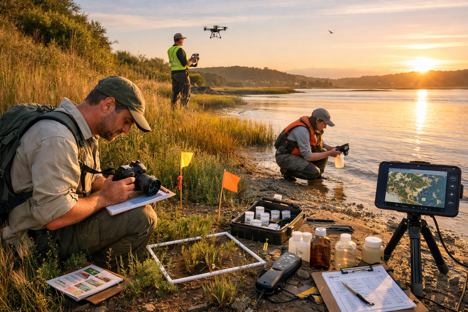
Successfully implementing Coastal Ecosystem Surveys for Biodiversity Net Gain: Integrating Land-Sea Interactions in 2026 Baseline Assessments requires careful planning and multi-disciplinary expertise.
Pre-Survey Planning Essentials
Assemble appropriate expertise:
- Terrestrial ecologists with UKHab and condition assessment experience
- Marine biologists with benthic survey and underwater survey skills
- GIS specialists for spatial data integration
- Hydrologists for understanding tidal and freshwater influences
Secure necessary permissions:
- Marine licensing for surveys below mean high water
- Landowner permissions for terrestrial access
- Consultation with statutory nature conservation bodies
- Permits for protected species surveys if required
Plan survey timing strategically:
- Schedule terrestrial surveys during optimal botanical survey season
- Coordinate marine surveys with suitable weather windows
- Conduct intertidal surveys at appropriate tidal stages
- Allow multiple survey visits to capture temporal variability
Prepare appropriate equipment:
- Standard terrestrial survey equipment (GPS, cameras, measuring tools)
- Marine survey equipment (benthic samplers, underwater cameras, water quality meters)
- Safety equipment for working in coastal environments
- Data recording systems compatible with both terrestrial and marine metrics
Data Integration and Baseline Calculation
Integrating terrestrial and marine survey data presents technical challenges that require thoughtful approaches:
Spatial data management:
- Use consistent coordinate systems across terrestrial and marine datasets
- Create seamless habitat maps that span the land-sea interface
- Document transition zones with appropriate detail
- Maintain metadata describing survey methods and conditions
Metric application:
- Apply statutory biodiversity metric to terrestrial habitats following standard protocols
- Adapt emerging marine metric guidance to marine habitats as frameworks develop
- Document assumptions and limitations where marine metrics remain under development
- Consider provisional approaches that can be updated as guidance evolves
Baseline documentation:
- Produce comprehensive baseline reports that integrate terrestrial and marine components
- Include photographic evidence from both environments
- Provide clear justifications for condition assessments across all habitat types
- Document connectivity and ecological relationships between terrestrial and marine areas
For developers working on coastal projects, understanding what's included in a biodiversity net gain assessment provides essential context for commissioning appropriate baseline surveys.
Common Challenges and Solutions
Challenge: Marine metric frameworks remain under development[1]
Solution: Apply best available guidance while documenting methodology transparently; engage early with regulators to agree provisional approaches; design surveys to collect data compatible with anticipated metric development
Challenge: Tidal access limitations restrict survey timing
Solution: Plan extended survey programs with multiple site visits; coordinate terrestrial and marine surveys to maximize efficiency during accessible periods; use remote sensing to supplement field surveys
Challenge: Habitat boundaries are dynamic and difficult to define precisely
Solution: Adopt adaptive management frameworks that define assessment areas based on ecological processes; document natural variability; use multiple survey dates to characterize typical conditions; incorporate buffer zones
Challenge: Multi-disciplinary expertise increases survey costs
Solution: Demonstrate value through comprehensive baseline data that reduces planning risk; consider phased survey approaches; explore opportunities for on-site versus off-site delivery that may reduce overall project costs
Future Directions: Coastal Innovation for Climate and Biodiversity
Coastal innovation is increasingly recognized as critical for addressing both climate change and biodiversity loss.[7] Coastal Ecosystem Surveys for Biodiversity Net Gain: Integrating Land-Sea Interactions in 2026 Baseline Assessments sit at the intersection of these global challenges.
Emerging Technologies
Remote sensing advances:
- Satellite imagery with improved resolution for habitat mapping
- Drone-mounted multispectral sensors for vegetation and water quality assessment
- LiDAR for detailed topographic and bathymetric mapping
- Automated image analysis using machine learning for habitat classification
Environmental DNA (eDNA):
- Water sampling to detect marine species presence
- Sediment sampling for benthic biodiversity assessment
- Cost-effective complement to traditional survey methods
- Potential for standardized protocols across sites
Acoustic monitoring:
- Passive acoustic monitoring for marine mammal and fish populations
- Soundscape analysis to assess ecosystem health
- Long-term deployment for temporal variability assessment
- Integration with traditional survey data
Policy Development Trajectory
As Marine Net Gain frameworks continue to mature, practitioners can anticipate:
📋 Standardized marine metrics: Development of statutory metrics comparable to terrestrial biodiversity metric
📋 Clearer guidance: Regulatory clarity on assessment requirements for coastal and marine habitats
📋 Integrated approaches: Recognition of land-sea connectivity in policy frameworks
📋 Market mechanisms: Emergence of marine biodiversity unit markets alongside terrestrial markets
Ecologists conducting baseline assessments in 2026 are establishing precedents and generating data that will inform these policy developments. Rigorous, well-documented coastal surveys contribute to the evidence base supporting effective Marine Net Gain implementation.
Conclusion
Coastal Ecosystem Surveys for Biodiversity Net Gain: Integrating Land-Sea Interactions in 2026 Baseline Assessments represent a critical evolution in environmental assessment practice. As coastal development pressures intensify and climate change accelerates habitat transformation, the need for comprehensive, integrated baseline data has never been greater.
The transition from terrestrial-only BNG approaches to truly integrated coastal assessments requires:
🔍 Methodological innovation: Combining terrestrial field survey protocols with marine benthic sampling, acoustic surveys, and remote sensing techniques
🌊 Ecological understanding: Recognizing that coastal biodiversity doesn't respect arbitrary boundaries between land and sea
📊 Adaptive frameworks: Moving beyond rigid boundary definitions to process-based assessments that accommodate dynamic coastal systems
🤝 Multi-disciplinary collaboration: Bringing together terrestrial ecologists, marine biologists, and specialists in transition zone habitats
💡 Forward-thinking approaches: Integrating blue carbon potential and climate adaptation considerations alongside traditional biodiversity metrics
Actionable Next Steps
For ecologists planning coastal baseline surveys:
-
Assess project scope early: Determine whether developments affect only terrestrial habitats, only marine habitats, or span the land-sea interface requiring integrated assessment
-
Assemble appropriate expertise: Ensure survey teams include specialists with relevant terrestrial and marine survey experience
-
Engage regulators proactively: Discuss assessment approaches with planning authorities and statutory nature conservation bodies, particularly where marine metric frameworks remain under development
-
Plan comprehensive surveys: Design survey programs that capture spatial and temporal variability across coastal gradients
-
Document thoroughly: Create baseline reports that transparently describe methodologies, justify condition assessments, and acknowledge limitations
-
Stay informed: Monitor emerging guidance on Marine Net Gain as frameworks continue to develop
-
Consider broader benefits: Explore opportunities to integrate biodiversity net gain with blue carbon initiatives and climate adaptation objectives
For developers commissioning coastal surveys, working with experienced practitioners who understand both terrestrial BNG requirements and emerging marine frameworks ensures robust baseline data that withstands regulatory scrutiny and supports successful project delivery.
The coastal zone represents one of Earth's most productive and biodiverse environments. By conducting Coastal Ecosystem Surveys for Biodiversity Net Gain: Integrating Land-Sea Interactions in 2026 Baseline Assessments that truly capture the ecological complexity of these remarkable transition zones, practitioners can ensure that development delivers genuine conservation gains for interconnected terrestrial and marine ecosystems.
References
[1] Marine Biodiversity Net Gain Explained – https://gaiacompany.io/marine-biodiversity-net-gain-explained/
[2] Nature Credits Eus Coastal And Marine Ecosystems 2026 01 30 En – https://maritime-forum.ec.europa.eu/events/nature-credits-eus-coastal-and-marine-ecosystems-2026-01-30_en
[3] Biodiversity Net Gain Bng Surveys – https://acp-consultants.com/biodiversity-net-gain/biodiversity-net-gain-bng-surveys/
[4] Whats Next For Biodiversity Conservation Insights From The 2026 Horizon Scan – https://www.unep-wcmc.org/en/news/whats-next-for-biodiversity-conservation-insights-from-the-2026-horizon-scan
[7] Coastal Innovation Is Critical For Climate And Biodiversity – https://sdg.iisd.org/commentary/guest-articles/coastal-innovation-is-critical-for-climate-and-biodiversity/
