
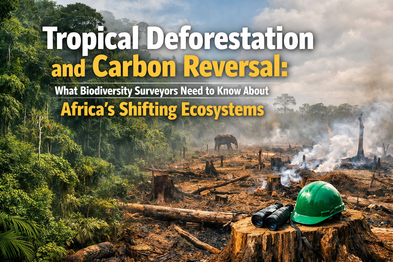
{"cover":"Professional landscape format (1536×1024) hero image featuring bold text overlay 'Tropical Deforestation and Carbon Reversal: What Biodiversity Surveyors Need to Know About Africa's Shifting Ecosystems' in extra large 72pt white sans-serif font with dark shadow and semi-transparent overlay box, positioned in upper third. Background shows dramatic split composition: left side displays lush Congo Basin rainforest canopy with dense green vegetation and mist, right side shows cleared deforested land with tree stumps and exposed red soil. Satellite imagery overlay with carbon measurement data points. Color scheme: deep forest green, burnt orange, white text. High contrast, National Geographic editorial quality, environmental documentary aesthetic with professional scientific gravitas.","content":["Landscape format (1536×1024) detailed infographic showing Africa's carbon balance reversal timeline from 2007-2017. Split timeline visualization with green upward arrow (2007-2010) labeled 'Carbon Sink Period' showing +20 million tonnes annual absorption, then dramatic red downward arrow (2010-2017) labeled 'Carbon Source Period' showing -106 million tonnes annual loss. Background features faded satellite map of Africa with Democratic Republic of Congo, Madagascar, and West Africa highlighted in red heat zones. Includes visual comparison: 106 million cars icon representing equivalent biomass weight loss. Data points from GEDI laser and ALOS radar satellites illustrated. Professional scientific publication style with clean typography, data visualization excellence, environmental monitoring aesthetic.","Landscape format (1536×1024) detailed scene showing biodiversity surveyor in field conducting tropical forest assessment in African rainforest setting. Foreground shows professional with tablet displaying digital mapping software, GPS equipment, and biomass measurement tools including dendrometer and soil carbon testing kit. Mid-ground features dense tropical vegetation with visible tree tags and survey markers. Background shows forest canopy with subtle signs of degradation and edge effects. Equipment close-up includes LIDAR scanner, drone for aerial survey, and field notebook with carbon stock calculations. Warm natural lighting, documentary photography style, professional ecological fieldwork aesthetic emphasizing modern survey technology and methodological adaptation.","Landscape format (1536×1024) conceptual illustration showing restoration and conservation strategies across African landscape. Foreground displays AFR100 initiative visual with '100 million hectares by 2030' text overlay and restoration progress meter. Mid-ground shows three distinct zones: protected intact forest with wildlife silhouettes, active restoration area with young tree saplings and community planting activities, and sustainable agroforestry buffer zone. Background features Tropical Forests Forever Facility funding flow diagram with arrows connecting international climate finance to local conservation projects. Includes carbon credit certification symbols and biodiversity net gain measurement icons. Hopeful color palette: vibrant greens, earth tones, sky blue. Professional environmental policy aesthetic with infographic elements, solution-focused composition."]"}
Africa's forests absorbed roughly 20% of global carbon emissions through photosynthesis until 2010—then everything changed. Between 2010 and 2017, the continent's forests lost approximately 106 million tonnes of biomass annually, transforming from vital carbon sinks into net carbon sources.[1] This fundamental ecological regime shift demands that biodiversity surveyors working in African ecosystems fundamentally revise their baseline assessment protocols in 2026.
Understanding Tropical Deforestation and Carbon Reversal: What Biodiversity Surveyors Need to Know About Africa's Shifting Ecosystems has become essential for professionals conducting ecological assessments, carbon accounting, and conservation planning across the continent. The reversal represents not just a statistical change but a profound transformation in how African landscapes function within the global carbon cycle.
Key Takeaways
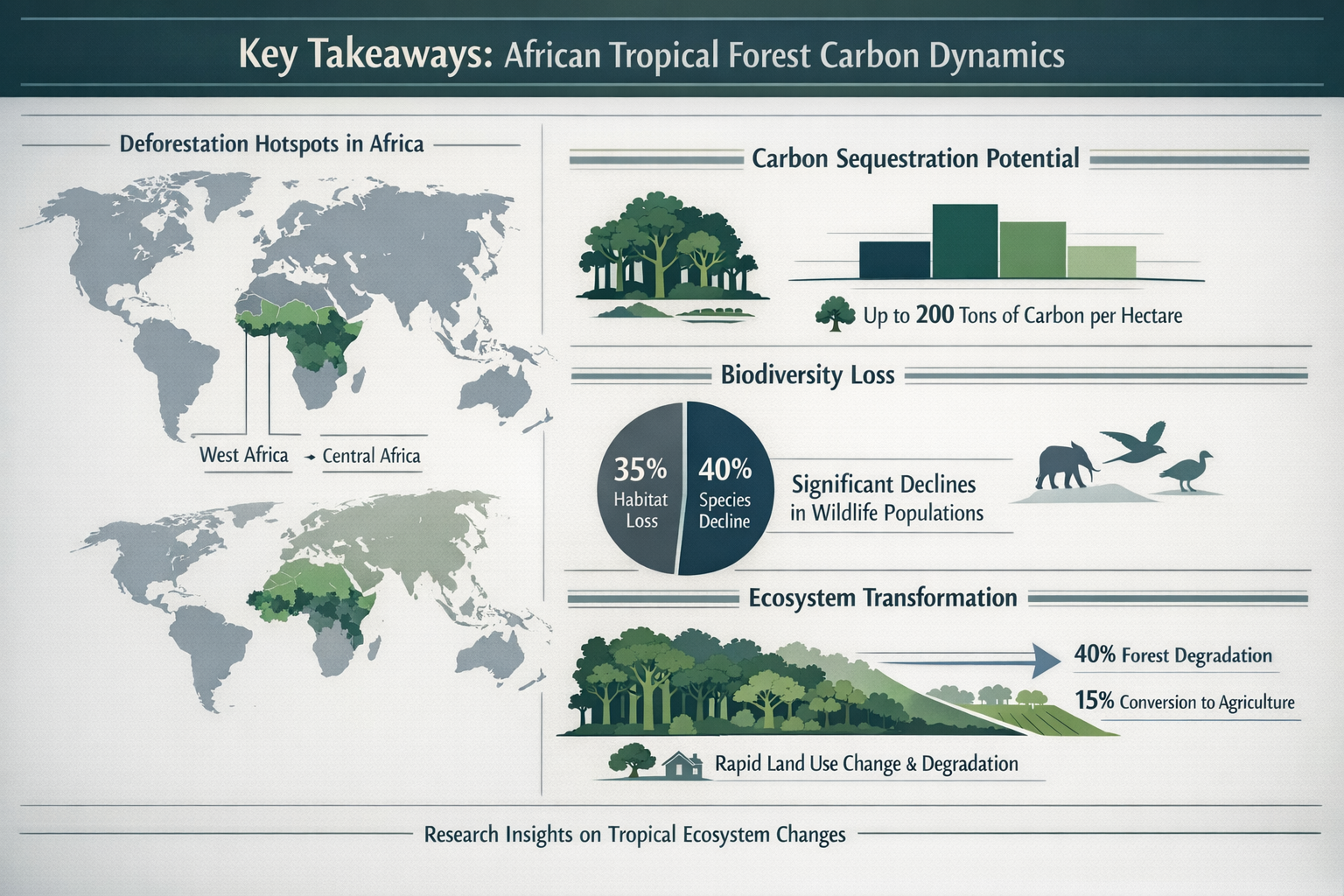
- Carbon sink to source transition: Africa's forests shifted from absorbing carbon (2007-2010) to emitting approximately 200 million tonnes of CO₂ annually after 2010, primarily due to tropical deforestation.[2]
- Massive biomass losses: Between 2010-2017, Africa lost 106 million tonnes of forest biomass per year—equivalent to the weight of 106 million cars—concentrated in the Democratic Republic of Congo, Madagascar, and West Africa.[1]
- Survey protocol adaptation required: Biodiversity surveyors must update baseline methodologies to account for accelerated degradation patterns, using advanced satellite data and machine learning tools to capture rapid ecosystem changes.[3]
- Regional disparities matter: While some savanna areas gained biomass through shrub encroachment, these gains proved insufficient to offset tropical moist broadleaf forest losses, requiring location-specific assessment approaches.[2]
- Global implications: The reversal increases pressure on other regions to cut emissions more deeply to meet Paris Agreement targets, making accurate African ecosystem monitoring critical for international climate policy.[4]
Understanding the Carbon Reversal in African Forests
The Timeline of Transformation
Between 2007 and 2010, Africa's forests functioned as robust carbon sinks, actively removing greenhouse gases from the atmosphere. However, research published in Scientific Reports by the National Centre for Earth Observation revealed a dramatic reversal after 2010.[1] This shift wasn't gradual—it represented a fundamental change in ecosystem function driven by accelerating tropical deforestation patterns.
The numbers tell a stark story. From 2010 to 2015, Africa lost 132 million tons of biomass per year. While the rate slowed to 41 million tons annually between 2015 and 2017, the continent continued experiencing net losses.[4] When converted to carbon dioxide equivalents, the 106 million tonnes of annual biomass loss translates to approximately 200 million tonnes of CO₂ emissions—a massive contribution to global greenhouse gas concentrations.[3]
Geographic Hotspots of Degradation
The losses concentrate heavily in tropical moist broadleaf forests, particularly in three critical regions:
🌳 Democratic Republic of Congo: Home to the world's second-largest tropical rainforest block, the Congo Basin experienced severe degradation from logging, agricultural expansion, and mining activities.
🌳 Madagascar: This biodiversity hotspot faced intense pressure from slash-and-burn agriculture and illegal logging, resulting in dramatic forest cover reductions.
🌳 West Africa: Coastal and interior forests across Ghana, Côte d'Ivoire, Nigeria, and surrounding countries suffered from rapid conversion to cocoa plantations, palm oil operations, and urban expansion.
These regional patterns matter immensely for biodiversity surveyors. Understanding where degradation concentrates helps professionals prioritize assessment efforts and develop location-specific monitoring protocols. Similar to how biodiversity net gain assessments require detailed baseline data, African ecosystem surveys now demand recognition of these accelerated change patterns.
The Savanna Paradox
Interestingly, some African savanna regions experienced biomass gains during the study period due to shrub encroachment—a process where woody vegetation expands into grasslands.[2] However, these gains proved far too small to offset the massive losses in tropical forests. This creates a critical challenge for surveyors: regional ecosystem responses vary dramatically, requiring differentiated assessment approaches rather than continent-wide generalizations.
Tropical Deforestation and Carbon Reversal: Implications for Biodiversity Survey Methodologies
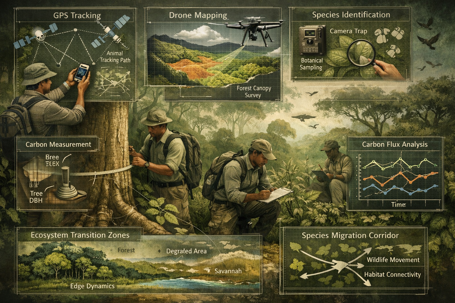
Advanced Technology Integration
The research documenting Africa's carbon reversal employed cutting-edge technology that biodiversity surveyors should incorporate into their 2026 protocols. Scientists used NASA's GEDI (Global Ecosystem Dynamics Investigation) laser instrument and Japan's ALOS PALSAR radar satellites, combined with machine learning algorithms and ground-based measurements, to create the most detailed aboveground biomass change map yet available for Africa.[1]
This technological approach offers several advantages for field surveyors:
LIDAR and Radar Integration: These tools penetrate forest canopies to measure three-dimensional structure, providing accurate biomass estimates without extensive ground sampling.
Machine Learning Analysis: AI algorithms can process vast satellite datasets to identify degradation patterns at local scales, enabling surveyors to target high-priority areas for detailed assessment.
Temporal Tracking: Decade-long monitoring (2007-2017 in the research) reveals change trajectories that single-point surveys miss entirely.[2]
For professionals working on biodiversity impact assessments, integrating these technologies provides more robust baseline data and improves change detection capabilities.
Revised Baseline Protocols
Traditional biodiversity surveys often assume relatively stable ecosystem conditions between assessment periods. However, Tropical Deforestation and Carbon Reversal: What Biodiversity Surveyors Need to Know About Africa's Shifting Ecosystems fundamentally challenges this assumption. The post-2010 acceleration of degradation means that baselines established even five years ago may no longer reflect current conditions.
Surveyors should implement these protocol adjustments:
-
Shortened reassessment intervals: Instead of 5-10 year cycles, consider 2-3 year monitoring frequencies in high-change areas.
-
Dynamic reference conditions: Replace static historical baselines with trajectory-based models that account for ongoing degradation trends.
-
Carbon stock integration: Incorporate aboveground biomass measurements alongside traditional species inventories to capture ecosystem function changes.
-
Edge effect expansion: Recognize that forest fragmentation creates larger edge zones with altered microclimates, requiring expanded buffer assessments.
-
Degradation gradient mapping: Document not just presence/absence but degradation intensity across survey areas.
These adjustments align with emerging best practices in biodiversity net gain planning, where understanding baseline conditions accurately determines whether development projects can achieve required improvements.
Species-Specific Considerations
The carbon reversal doesn't affect all species equally. Biodiversity surveyors must recognize that:
Forest specialists face the greatest pressure as habitat quality declines. Species requiring intact canopy structure, specific microclimates, or large territories experience population declines even before complete deforestation occurs.
Edge-adapted species may temporarily increase as fragmentation creates more boundary habitat, potentially masking overall biodiversity losses in simple species counts.
Invasive species often exploit disturbed conditions, requiring surveyors to distinguish between native biodiversity and opportunistic colonizers.
Carbon-dependent processes like seed dispersal by large frugivores become disrupted as tree species composition shifts toward faster-growing, lower-density species with reduced carbon storage capacity.
Policy Frameworks and Conservation Responses to Tropical Deforestation and Carbon Reversal
International Climate Finance Mechanisms
The recognition that Africa's forests no longer absorb carbon has catalyzed new policy responses. At COP30 in Brazil (late 2025), international negotiators announced the Tropical Forests Forever Facility, designed to mobilize billions in climate finance to compensate forested countries for maintaining intact forests.[2]
This facility creates opportunities and obligations for biodiversity surveyors:
Verification requirements: Climate finance mechanisms demand rigorous monitoring, reporting, and verification (MRV) systems. Surveyors with expertise in carbon accounting and biodiversity assessment become essential for accessing these funds.
Baseline documentation: Countries seeking compensation must demonstrate forest protection, requiring comprehensive baseline surveys that document current conditions and establish monitoring protocols.
Co-benefits assessment: Funders increasingly require evidence that forest protection delivers biodiversity benefits alongside carbon sequestration, necessitating integrated ecological assessments.
The COP27 discussions on biodiversity and net zero laid groundwork for these mechanisms, emphasizing the interconnection between climate and nature goals.
The AFR100 Restoration Initiative
The African Forest Landscape Restoration Initiative (AFR100) targets restoration of 100 million hectares of African landscapes by 2030.[1] This ambitious goal represents a direct response to the biomass losses documented in recent research.
For biodiversity surveyors, AFR100 creates substantial work opportunities but also methodological challenges:
| Survey Need | Methodological Consideration | Timeline |
|---|---|---|
| Pre-restoration baseline | Document degraded condition, remaining biodiversity, carbon stocks | Before intervention |
| Restoration planning | Identify appropriate species, assess site conditions, design monitoring | Year 0-1 |
| Implementation monitoring | Track survival rates, growth, colonization by native species | Years 1-5 |
| Long-term assessment | Evaluate carbon accumulation, biodiversity recovery, ecosystem function | Years 5-30 |
Restoration projects require different survey approaches than intact forest monitoring. Surveyors must assess recovery trajectories rather than simply documenting current conditions. This parallels the approach used in biodiversity net gain delivery, where monitoring tracks improvement over time against defined targets.
National Policy Adaptations
Individual African nations are developing policy responses to the carbon reversal, creating varied regulatory environments for biodiversity surveyors:
Enhanced forest monitoring systems: Countries like Ghana and Kenya are implementing national forest monitoring systems using satellite data, requiring standardized survey protocols and data sharing.
Stricter logging regulations: Several nations have tightened timber harvest rules, necessitating pre-harvest biodiversity assessments and post-harvest monitoring.
Agricultural expansion controls: Some countries now require environmental impact assessments for large-scale agricultural conversions, creating demand for comprehensive biodiversity surveys.
Community forest management: Devolution of forest management to local communities requires participatory monitoring approaches where surveyors train and work alongside community members.
These policy developments mirror trends in countries like the UK, where biodiversity net gain requirements have transformed how development projects approach ecological assessment.
Practical Guidance for Surveyors Working in African Ecosystems
Field Assessment Adaptations
Surveyors conducting fieldwork in Africa's changing ecosystems should implement these practical adjustments:
🔍 Expand degradation indicators: Beyond tree cover loss, document:
- Standing dead trees and snags
- Canopy gap frequency and size
- Liana (woody vine) abundance as a disturbance indicator
- Soil compaction and erosion evidence
- Non-native species presence and abundance
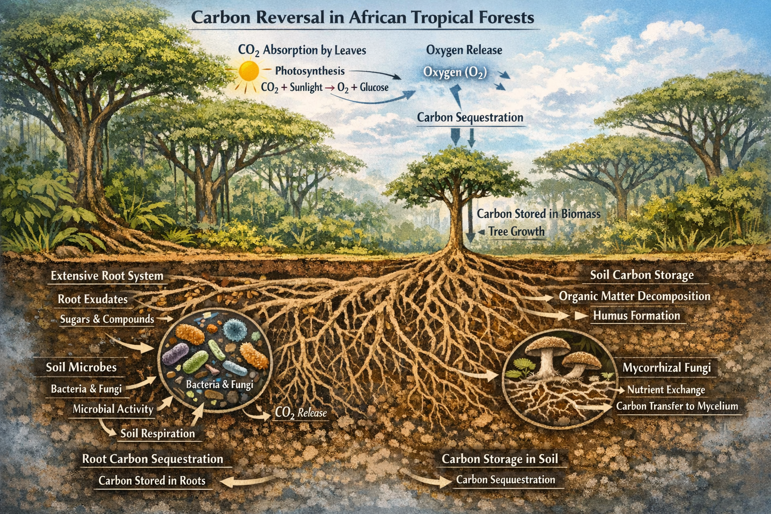
📊 Integrate carbon measurements: Add simple carbon stock assessments:
- Tree diameter measurements for biomass calculation
- Wood density sampling for key species
- Soil carbon testing in representative plots
- Deadwood volume quantification
🛰️ Leverage remote sensing: Use freely available satellite data:
- Global Forest Watch for recent deforestation alerts
- Sentinel-2 imagery for vegetation indices
- GEDI data for canopy height and structure
- ALOS PALSAR for biomass estimation
👥 Engage local knowledge: Community members often observe changes that periodic surveys miss:
- Species disappearances or declines
- Phenology shifts (flowering, fruiting timing)
- Wildlife movement pattern changes
- Water availability alterations
Data Management and Reporting
The accelerated pace of change in African ecosystems demands more sophisticated data management:
Temporal databases: Maintain time-series data that reveals trends rather than just snapshots. This allows detection of gradual degradation that might not be apparent in single surveys.
Spatial referencing: Precise GPS coordinates enable exact plot relocation for monitoring, essential when documenting change over time.
Metadata documentation: Record survey conditions (season, weather, observer, methods) that might affect comparability between assessment periods.
Uncertainty quantification: Acknowledge and quantify uncertainty in estimates, particularly important when extrapolating from sample plots to landscape scales.
These data practices align with standards emerging in biodiversity net gain reporting, where transparency and reproducibility are increasingly required.
Capacity Building Priorities
African institutions and surveyors need targeted capacity building to address the carbon reversal challenge:
Technical training: Remote sensing interpretation, carbon accounting methods, statistical analysis of change data, and GIS applications for spatial analysis.
Equipment access: LIDAR units, drones, GPS devices, and field computers remain expensive but increasingly essential for modern surveys.
Data infrastructure: Cloud storage, database systems, and analytical software enable sophisticated monitoring programs.
Regional networks: Connecting surveyors across countries facilitates knowledge sharing about effective methods and emerging challenges.
International organizations and research institutions should prioritize supporting these capacity needs, recognizing that accurate monitoring of Africa's ecosystems benefits global climate and conservation goals.
Future Trajectories and Emerging Challenges
Climate Feedback Loops
The carbon reversal creates concerning feedback loops that surveyors must understand:
Reduced rainfall: Forest loss decreases evapotranspiration, potentially reducing regional rainfall and further stressing remaining forests—a cycle that accelerates degradation.
Increased fire risk: Fragmented, degraded forests become more susceptible to fire, which historically was rare in moist tropical forests but is becoming more common.
Pest and disease outbreaks: Stressed trees become more vulnerable to insect pests and pathogens, potentially causing rapid die-offs that surveys must detect early.
Species composition shifts: As conditions change, fast-growing pioneer species replace slow-growing hardwoods, altering forest structure and reducing carbon storage capacity even in "intact" forests.
These dynamics mean that Tropical Deforestation and Carbon Reversal: What Biodiversity Surveyors Need to Know About Africa's Shifting Ecosystems extends beyond current conditions to anticipating future trajectories.
Technology Evolution
Emerging technologies will transform African ecosystem monitoring:
Autonomous drones: Increasingly affordable drones with LIDAR and multispectral sensors enable high-resolution mapping at landscape scales.
AI species identification: Machine learning models can identify species from images and sounds, potentially automating portions of biodiversity surveys.
Environmental DNA (eDNA): Water and soil samples can reveal species presence without direct observation, particularly valuable for rare or cryptic species.
Real-time monitoring: Sensor networks and camera traps provide continuous data rather than periodic snapshots, detecting changes as they occur.
Surveyors should stay current with these technological advances, recognizing that methods will continue evolving rapidly.
Economic Pressures and Opportunities
Africa's human population continues growing, increasing pressure on forests for agriculture, timber, and fuelwood. However, economic opportunities also exist:
Carbon markets: Voluntary and compliance carbon markets may provide revenue for forest protection, though verification requirements create survey work.
Ecotourism: Well-managed tourism generates income from intact forests, requiring biodiversity monitoring to ensure sustainability.
Sustainable forestry: Certified sustainable timber operations need rigorous ecological assessments to maintain certification.
Restoration employment: Large-scale restoration initiatives create jobs in nursery operations, planting, and monitoring.
Understanding these economic dynamics helps surveyors position their work within broader sustainable development frameworks, similar to how biodiversity credits create economic value from ecological improvement.
Conclusion
The transformation of Africa's forests from carbon sinks to carbon sources after 2010 represents one of the most significant ecological shifts of the 21st century. For biodiversity surveyors working across the continent in 2026, this reversal demands fundamental changes in assessment protocols, baseline assumptions, and monitoring approaches.
The research documenting 106 million tonnes of annual biomass loss—equivalent to 200 million tonnes of CO₂ emissions—reveals the scale and urgency of the challenge.[1][3] Concentrated in tropical moist broadleaf forests of the Democratic Republic of Congo, Madagascar, and West Africa, these losses reflect accelerating deforestation that overwhelms the modest gains occurring in some savanna regions.
Tropical Deforestation and Carbon Reversal: What Biodiversity Surveyors Need to Know About Africa's Shifting Ecosystems encompasses both technical and strategic dimensions. Technically, surveyors must integrate advanced remote sensing technologies, shorten reassessment intervals, incorporate carbon stock measurements, and adopt dynamic baseline approaches that account for ongoing degradation. Strategically, professionals must position their work within emerging policy frameworks like the Tropical Forests Forever Facility and AFR100 restoration initiative, recognizing that accurate monitoring underpins both climate finance and conservation effectiveness.
The implications extend globally. If Africa's forests no longer absorb carbon, other regions must cut emissions more deeply to meet Paris Agreement targets.[4] This reality elevates the importance of African ecosystem monitoring from a regional concern to a global imperative.
Actionable Next Steps for Biodiversity Surveyors
-
Update technical skills: Invest in training on remote sensing interpretation, carbon accounting methods, and machine learning applications for ecological monitoring.
-
Revise protocols: Review and update survey methodologies to incorporate shorter assessment cycles, dynamic baselines, and degradation gradient mapping.
-
Integrate technology: Adopt satellite data sources, GPS precision, and temporal databases to enhance monitoring capabilities.
-
Engage policy frameworks: Understand emerging climate finance mechanisms and restoration initiatives that create opportunities for survey work.
-
Build networks: Connect with regional and international colleagues to share methods, data, and insights about effective monitoring in changing ecosystems.
-
Communicate findings: Translate technical survey results into accessible information for policymakers, communities, and conservation practitioners.
The carbon reversal in African forests challenges surveyors to evolve their practice, but it also underscores the critical importance of their work. Accurate, timely biodiversity and carbon monitoring provides the foundation for effective conservation responses, sustainable development decisions, and global climate action. As Africa's ecosystems continue shifting in 2026 and beyond, professional surveyors equipped with updated knowledge and methods will play an essential role in documenting change, guiding restoration, and supporting the policies needed to reverse degradation trends.
For surveyors seeking to understand how these African ecosystem dynamics relate to broader conservation frameworks, exploring biodiversity net gain principles provides valuable context on how monitoring supports measurable environmental improvement—a goal equally relevant whether working in African tropical forests or development projects elsewhere.
References
[1] sciencedaily – https://www.sciencedaily.com/releases/2026/04/260413043135.htm
[2] Africa Forests Absorbing Emitting Carbon – https://le.ac.uk/news/2025/november/africa-forests-absorbing-emitting-carbon
[3] Africas Forests Are Now Emitting Carbon Instead Of Absorbing It – https://carboncredits.com/africas-forests-are-now-emitting-carbon-instead-of-absorbing-it/
[4] aa.com.tr – https://www.aa.com.tr/en/greenline/climate-change/africa-s-forests-now-a-net-carbon-source-study-finds/1828992
