
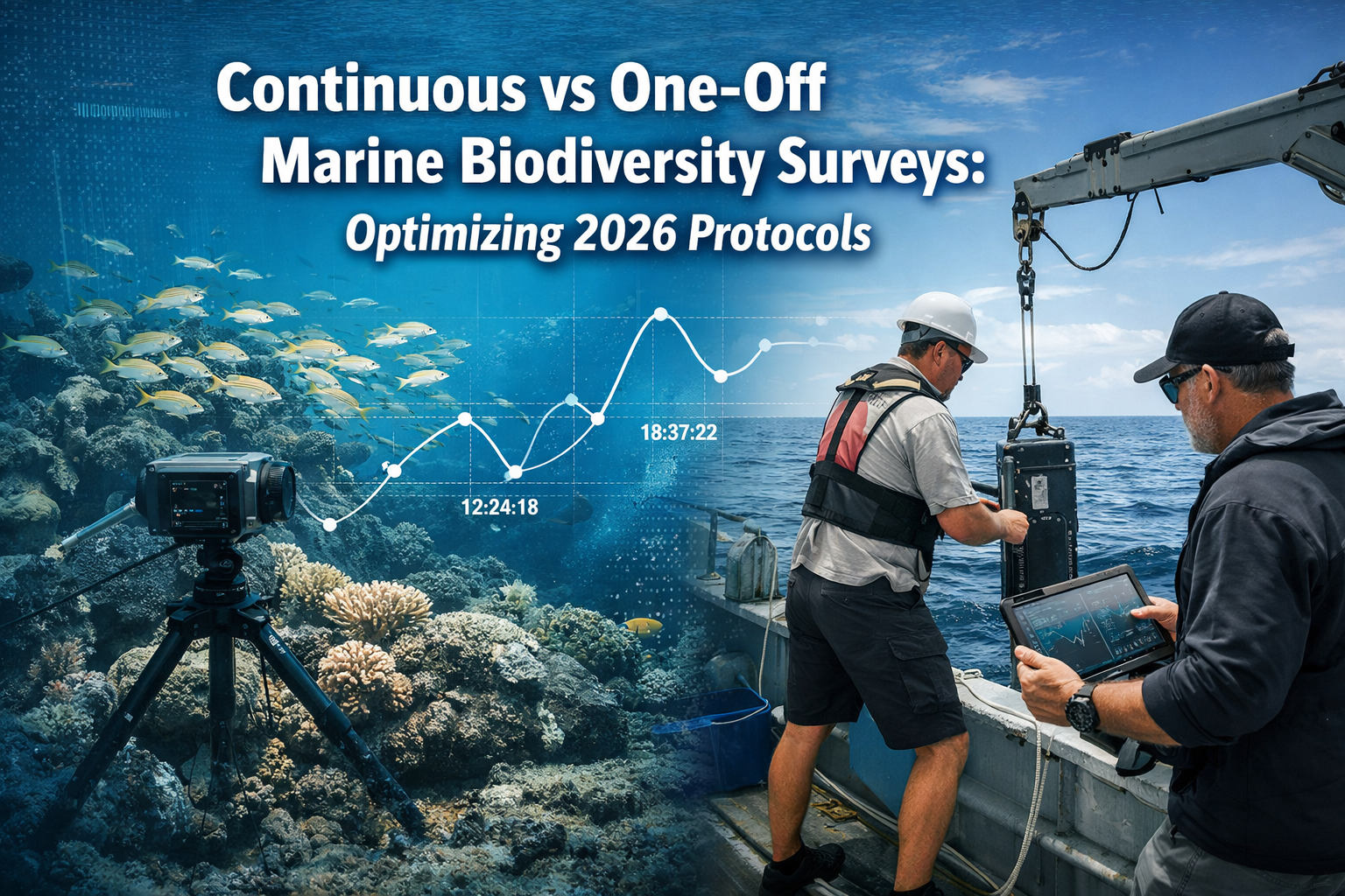
Marine ecosystems are changing faster than ever before. 🌊 Scientists and conservationists face a critical question in 2026: should biodiversity surveys capture a single moment in time, or track changes continuously throughout the year? The answer determines whether we can distinguish natural seasonal variations from genuine ecosystem decline. As the 2026 Global Horizon Scan emphasizes, baseline and trend monitoring have become critical for understanding marine biodiversity shifts caused by climate change and human activities[1][2]. This article explores Continuous vs One-Off Marine Biodiversity Surveys: Optimizing 2026 Protocols for Trend Detection, providing surveyors with practical tools for scalable, trend-focused monitoring that meets today's conservation challenges.
Key Takeaways
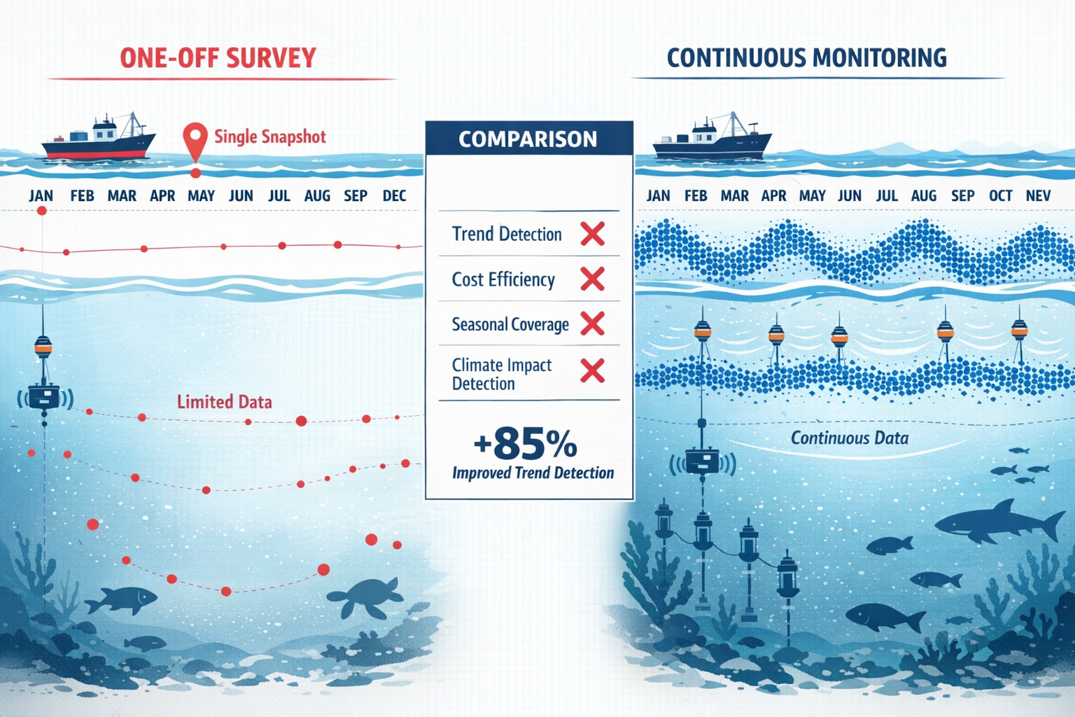
- Continuous monitoring captures seasonal variability and distinguishes natural fluctuations from actual biodiversity loss, while one-off surveys provide only snapshots that may miss critical changes
- 2026 protocols emphasize trend detection as essential for understanding emerging threats like ocean darkening and macroalgal habitat loss[2][5]
- Cost-effectiveness can be achieved through strategic sampling design, automated technologies, and hybrid approaches that balance frequency with budget constraints
- Digital twins and AI-powered tools are transforming how survey data gets interpreted and applied to conservation decisions[6]
- Optimized protocols require clear objectives upfront—knowing whether you need baseline documentation or long-term trend analysis determines the best survey approach
Understanding the Fundamental Differences in Marine Survey Approaches
The choice between continuous and one-off marine biodiversity surveys represents more than just a scheduling decision. It fundamentally shapes what questions researchers can answer and which conservation actions become possible.
What Are One-Off Marine Biodiversity Surveys?
One-off surveys capture marine biodiversity at a single point in time. Research teams visit a location, document species present, measure environmental conditions, and compile a snapshot report. These surveys excel at:
- Establishing initial baseline conditions for new study sites
- Meeting regulatory requirements for biodiversity impact assessments
- Providing rapid assessments for time-sensitive decisions
- Documenting species presence/absence efficiently
- Supporting spatial planning with benthic biodiversity mapping[4]
However, one-off surveys face significant limitations. Marine ecosystems experience natural variability across seasons, tidal cycles, and weather patterns. A single survey cannot distinguish whether low species counts reflect actual decline or simply seasonal migration patterns.
What Are Continuous Marine Biodiversity Surveys?
Continuous monitoring involves repeated surveys at regular intervals—monthly, quarterly, or seasonally—over extended periods (typically years). This approach enables:
- Trend detection that reveals whether biodiversity is increasing, decreasing, or remaining stable
- Separation of natural variability from human-caused changes
- Early warning of emerging threats before they become crises
- Understanding of seasonal patterns and life cycle dynamics
- Validation of conservation intervention effectiveness
The 2026 Global Horizon Scan identifies baseline and trend monitoring as critical priorities[1][2], reflecting growing recognition that continuous data collection provides the foundation for effective marine conservation.
Key Differences in Data Quality and Application
| Factor | One-Off Surveys | Continuous Surveys |
|---|---|---|
| Temporal Coverage | Single snapshot | Multiple time points |
| Trend Detection | ❌ Not possible | ✅ Primary strength |
| Seasonal Variability | ❌ Cannot assess | ✅ Fully captured |
| Initial Cost | 💰 Lower | 💰💰 Higher |
| Long-term Value | Limited insights | Comprehensive understanding |
| Regulatory Compliance | ✅ Often sufficient | ✅ Exceeds requirements |
| Climate Impact Detection | ❌ Inadequate | ✅ Essential capability |
Continuous vs One-Off Marine Biodiversity Surveys: Optimizing 2026 Protocols for Emerging Threats
The marine conservation landscape has evolved dramatically. New threats identified in 2026 require monitoring protocols specifically designed to detect subtle, progressive changes that one-off surveys would miss entirely.
Ocean Darkening and Light Penetration Changes
Ocean darkening—the decline in light penetration through marine waters—has emerged as a significant concern affecting productivity and food webs[2]. This phenomenon occurs gradually, making it invisible to snapshot surveys but detectable through continuous monitoring.
Optimized protocols for ocean darkening include:
- Quarterly light penetration measurements using Secchi disks or photometers at consistent depths
- Phytoplankton community composition tracking to identify shifts toward low-light adapted species
- Correlation analysis between light levels and higher trophic level abundance
- Integration with satellite remote sensing data for broader spatial context
Without continuous data, managers cannot determine whether darkening represents natural seasonal variation or a concerning long-term trend requiring intervention.
Macroalgal Habitat Loss and Kelp Forest Decline
Kelp forests and other macroalgal habitats face vulnerability to warming and extreme events[2][5]. These ecosystems provide critical habitat for countless species, making their monitoring essential for biodiversity conservation efforts.
Continuous monitoring protocols for macroalgal habitats should include:
- Seasonal canopy density assessments using underwater photography or sonar
- Temperature logger deployment to correlate thermal stress with habitat changes
- Species composition surveys tracking shifts from kelp to turf algae
- Recruitment monitoring to assess whether young kelp successfully establish
- Storm impact documentation before and after extreme weather events
"Marine biodiversity monitoring must capture full-season data to distinguish natural variability from genuine ecosystem loss. Single snapshots simply cannot provide the temporal resolution needed for effective conservation decision-making in 2026."
Climate Change Impact Detection
Climate change affects marine ecosystems through multiple pathways: temperature increases, acidification, deoxygenation, and altered circulation patterns. Detecting these impacts requires continuous observation that tracks both gradual shifts and sudden threshold crossings.
Optimized 2026 protocols integrate:
- Environmental sensors recording temperature, pH, dissolved oxygen, and salinity continuously
- Biological surveys conducted at consistent intervals to correlate with environmental data
- Community composition analysis identifying climate-sensitive indicator species
- Phenology tracking documenting shifts in breeding, migration, and seasonal behaviors
- Comparison with historical baselines to quantify rates of change
These approaches align with the emphasis on trend monitoring identified as critical for understanding biodiversity shifts[1][2].
Designing Cost-Effective Continuous Monitoring Programs
Budget constraints represent the most common objection to continuous marine biodiversity surveys. However, strategic protocol design can deliver trend detection capability at reasonable costs through smart sampling strategies and technology integration.
Strategic Sampling Design Principles
Optimized sampling balances frequency with coverage to maximize trend detection power while controlling costs:
Temporal Stratification: Rather than monthly surveys year-round, focus intensive sampling during key periods:
- Pre- and post-breeding seasons to capture recruitment success
- Seasonal transition periods when communities shift
- Known stress periods (summer heat, winter storms)
- Quarterly sampling with annual intensive surveys
Spatial Optimization: Select representative sites that:
- Capture habitat diversity across the study area
- Include reference sites with minimal human impact
- Cover gradients of exposure to stressors
- Allow comparison with biodiversity baseline data
Indicator Species Approach: Focus detailed monitoring on:
- Keystone species whose changes indicate ecosystem shifts
- Sensitive species that respond early to stressors
- Commercially or culturally important species
- Easily identifiable taxa that reduce survey time
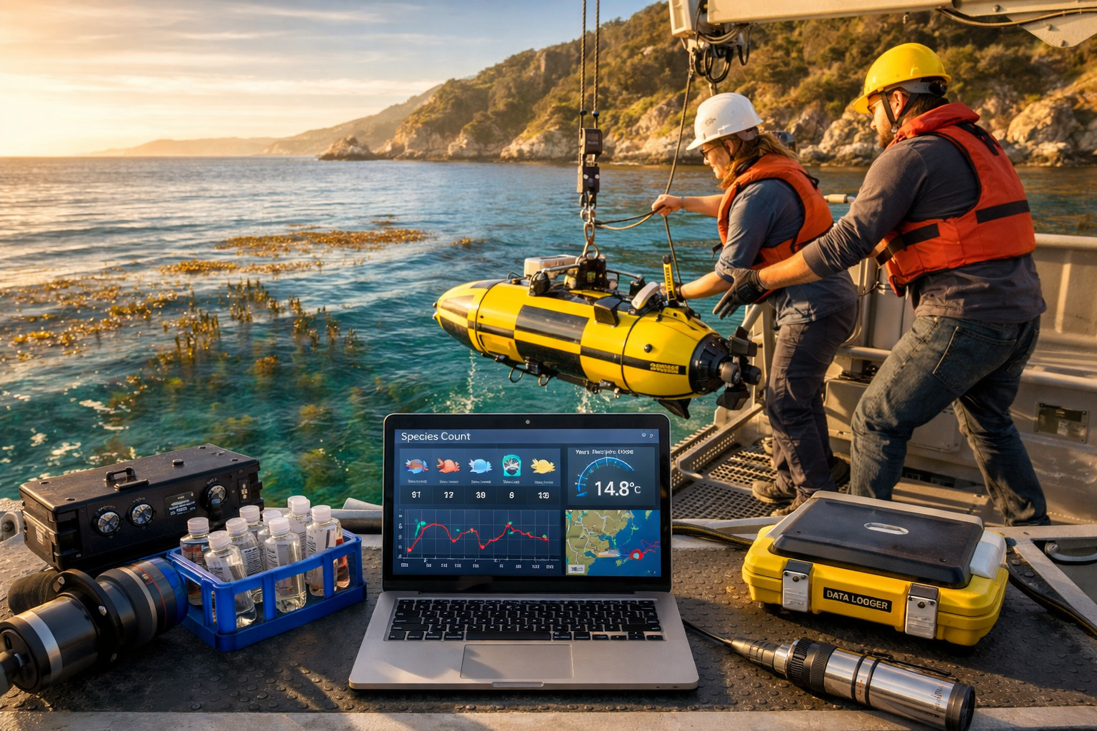
Technology Integration for Scalability
Modern technologies dramatically reduce the per-survey cost of continuous monitoring:
Autonomous Underwater Vehicles (AUVs) conduct surveys without vessel support, reducing personnel costs by 60-70% for routine monitoring.
Fixed Sensor Arrays provide continuous environmental data (temperature, pH, oxygen, turbidity) at minimal ongoing cost after initial installation.
Acoustic Monitoring captures fish and marine mammal presence continuously, with AI-powered species identification processing thousands of hours of recordings automatically.
Environmental DNA (eDNA) sampling detects species presence from water samples, enabling broader taxonomic coverage with less specialized expertise than traditional visual surveys.
Digital Twins represent an emerging 2026 trend[6], using computer simulations of marine systems to interpolate between survey points and predict ecosystem responses to stressors.
Hybrid Approaches: Combining One-Off and Continuous Elements
Hybrid protocols offer practical middle ground for organizations transitioning toward continuous monitoring:
- Annual comprehensive surveys providing detailed baseline updates
- Quarterly rapid assessments tracking key indicators between comprehensive surveys
- Continuous automated monitoring for environmental parameters
- Event-triggered surveys responding to storms, blooms, or other disturbances
- Citizen science integration expanding temporal and spatial coverage cost-effectively
This tiered approach delivers trend detection capability while maintaining budget feasibility, similar to how biodiversity net gain strategies balance conservation goals with development realities.
Implementing Optimized 2026 Protocols: A Practical Framework
Selecting the right survey approach requires systematic evaluation of objectives, constraints, and available resources. This decision framework guides protocol optimization for trend detection.
Step 1: Define Clear Survey Objectives
Start with the fundamental question: What decisions will this survey data inform?
Choose one-off surveys when:
- Regulatory compliance requires only presence/absence documentation
- Initial site characterization precedes more intensive monitoring
- Budget absolutely prohibits repeated visits
- Spatial coverage across many sites matters more than temporal detail
- Immediate development decisions cannot wait for multi-year data
Choose continuous surveys when:
- Trend detection is the primary objective
- Distinguishing natural variability from impacts is essential
- Long-term conservation effectiveness requires evaluation
- Climate change impacts need quantification
- Adaptive management depends on detecting ecosystem responses
Step 2: Assess Resource Availability and Constraints
Realistic resource evaluation prevents protocol failures:
Budget Considerations:
- Total available funding over project lifetime
- Annual allocation variability
- Flexibility to reallocate between years
- Potential for phased implementation
- Cost-sharing opportunities with partners
Personnel Capacity:
- In-house taxonomic expertise levels
- Availability of trained field staff
- Volunteer or citizen science potential
- Access to specialized consultants
- Training investment capability
Logistical Factors:
- Site accessibility across seasons
- Vessel and equipment availability
- Weather window reliability
- Permit and regulatory requirements
- Data management infrastructure
Step 3: Select Appropriate Sampling Frequency
Frequency optimization balances trend detection power against cost:
| Monitoring Objective | Minimum Frequency | Optimal Frequency |
|---|---|---|
| Climate trend detection | Annual | Seasonal (4×/year) |
| Habitat condition assessment | Biennial | Annual |
| Population dynamics | Seasonal | Monthly during active periods |
| Impact assessment | Pre/post only | Quarterly with controls |
| Restoration effectiveness | Annual | Biannual |
| Regulatory compliance | As required | As required + annual |
Statistical power analysis should guide frequency decisions. Detecting a 20% decline with 80% confidence typically requires 3-5 years of annual data or 2-3 years of seasonal data, depending on natural variability.
Step 4: Integrate Quality Control and Data Management
Consistent methodology across survey events is essential for trend detection:
- Standardized protocols documented in detail, including equipment specifications, survey timing windows, and data recording formats
- Observer training and calibration ensuring consistent species identification and abundance estimation
- Metadata documentation recording environmental conditions, survey effort, and any protocol deviations
- Real-time data validation catching errors while field correction remains possible
- Centralized data management using systems that facilitate long-term storage, quality control, and analysis
Poor quality control undermines the entire value proposition of continuous monitoring by introducing noise that obscures genuine trends.
Step 5: Plan for Adaptive Management Integration
Survey data only creates value when it informs decisions. Optimized 2026 protocols build in clear pathways from data to action:
- Threshold triggers defining what changes warrant management response
- Decision timelines specifying when data gets reviewed and by whom
- Stakeholder engagement ensuring relevant parties understand and trust findings
- Management options identified in advance for likely scenarios
- Feedback loops that evaluate whether management actions achieved intended outcomes
This approach aligns with broader biodiversity planning frameworks that integrate monitoring into conservation strategy.
Real-World Applications and Case Study Insights
Understanding how different organizations apply continuous versus one-off approaches provides practical guidance for protocol optimization.
Marine Protected Area Management
Marine protected areas (MPAs) typically require continuous monitoring to evaluate conservation effectiveness. Successful programs commonly implement:
- Baseline surveys at MPA establishment (one-off comprehensive assessment)
- Annual monitoring of key indicator species and habitats
- Five-year comprehensive reassessments comparing against baseline
- Continuous environmental monitoring via sensor arrays
- Opportunistic surveys responding to unusual events
This hybrid approach provides trend detection capability while maintaining cost-effectiveness over decades of management.
Development Impact Assessment
Projects requiring biodiversity impact assessments often use one-off pre-construction surveys but increasingly incorporate post-construction monitoring:
- Pre-construction baseline (one-off comprehensive survey during optimal season)
- Construction monitoring (quarterly surveys during active work)
- Post-construction assessment (annual surveys for 3-5 years)
- Long-term monitoring (biennial surveys if impacts detected)
This progression allows detection of construction impacts while controlling costs, similar to biodiversity net gain monitoring requirements.
Climate Change Research Programs
Long-term ecological research focused on climate impacts relies almost exclusively on continuous monitoring:
- Decadal time series providing statistical power to detect gradual changes
- Seasonal sampling capturing phenological shifts
- Extreme event documentation through opportunistic rapid response surveys
- Multi-site networks separating local from regional patterns
- Integration with oceanographic monitoring correlating biological and physical changes
These programs generate the foundational understanding of marine ecosystem responses to climate change[2][5].
Future Directions: Emerging Technologies and Methodologies
The field of marine biodiversity monitoring continues evolving rapidly. Several 2026 trends promise to further optimize survey protocols for trend detection.
Artificial Intelligence and Machine Learning
AI-powered species identification from imagery and acoustic recordings is transforming survey efficiency:
- Automated processing of thousands of underwater photographs
- Real-time species identification during surveys
- Consistent identification reducing observer bias
- Expanded taxonomic coverage beyond specialist expertise
- Integration with biodiversity assessment workflows
Digital Twins and Predictive Modeling
Digital twins—computer simulations of marine ecosystems—represent a significant 2026 sustainability trend[6]. These tools:
- Interpolate between survey points to estimate ecosystem state continuously
- Predict ecosystem responses to management scenarios
- Identify optimal survey timing and locations
- Integrate multiple data streams (surveys, sensors, remote sensing)
- Support decision-making with uncertainty quantification
Citizen Science and Community Monitoring
Expanded participation in marine monitoring increases temporal and spatial coverage:
- Mobile apps enabling species observations by recreational divers
- Beach survey programs documenting intertidal communities
- Fishing community engagement tracking catch composition changes
- School partnerships conducting regular local monitoring
- Quality control protocols ensuring data reliability
Integrated Multi-Platform Approaches
Optimal 2026 protocols increasingly combine multiple monitoring platforms:
- Satellite remote sensing for broad spatial coverage
- Autonomous vehicles for systematic surveys
- Fixed sensor networks for continuous environmental data
- Traditional dive surveys for detailed biological assessment
- eDNA sampling for comprehensive biodiversity inventories
This integration provides the comprehensive, continuous data needed for robust trend detection while optimizing cost-effectiveness.
Conclusion
The choice between continuous and one-off marine biodiversity surveys fundamentally shapes conservation outcomes in 2026. While one-off surveys serve important purposes for baseline establishment and regulatory compliance, continuous monitoring provides the only pathway to robust trend detection essential for understanding marine ecosystem responses to climate change and human pressures.
The 2026 Global Horizon Scan's emphasis on baseline and trend monitoring[1][2] reflects growing recognition that marine conservation requires full-season data to distinguish natural variability from genuine biodiversity loss. Emerging threats like ocean darkening and macroalgal habitat loss[2][5] demand monitoring protocols specifically designed to detect subtle, progressive changes over time.
Optimized protocols balance trend detection capability with practical constraints through strategic sampling design, technology integration, and hybrid approaches. Digital twins, AI-powered identification tools, and autonomous monitoring platforms[6] are making continuous monitoring increasingly cost-effective and scalable.
Actionable Next Steps for Marine Surveyors
-
Evaluate current monitoring programs against the decision framework presented here—do your protocols match your actual objectives?
-
Pilot hybrid approaches that add quarterly rapid assessments to existing annual surveys, testing whether increased frequency improves trend detection
-
Invest in technology that reduces per-survey costs: autonomous vehicles, fixed sensors, AI identification tools, and eDNA sampling capabilities
-
Establish data management systems that support long-term trend analysis, not just individual survey reporting
-
Engage stakeholders early to build understanding of why continuous monitoring provides value worth the investment
-
Connect with broader conservation frameworks including biodiversity net gain planning to leverage synergies
-
Collaborate across organizations to share costs, standardize methods, and build regional monitoring networks
The marine ecosystems we seek to protect are changing rapidly. Survey protocols optimized for 2026 must provide the temporal resolution needed to detect, understand, and respond to those changes before critical thresholds are crossed. By thoughtfully selecting between continuous and one-off approaches—or strategically combining both—marine surveyors can deliver the trend detection capability that effective conservation demands. 🌊
References
[1] 2 Marine Biodiversity Its All About Baselines And Trends – https://www.wcmb2026.org/2-marine-biodiversity-its-all-about-baselines-and-trends
[2] Whats Next For Biodiversity Conservation Insights From The 2026 Horizon Scan – https://www.unep-wcmc.org/en/news/whats-next-for-biodiversity-conservation-insights-from-the-2026-horizon-scan
[4] Ecs2 – https://esajournals.onlinelibrary.wiley.com/doi/10.1002/ecs2.70494
[5] Conservation Horizon Scan Ai Drought Climate Change Tropical Forests Seaweed Southern Ocean – https://www.theinvadingsea.com/2026/01/02/conservation-horizon-scan-ai-drought-climate-change-tropical-forests-seaweed-southern-ocean/
[6] 3 Marine Sustainability Trends To Watch In 2026 – https://www.ecocoast.com/blogs/3-marine-sustainability-trends-to-watch-in-2026/
