
}
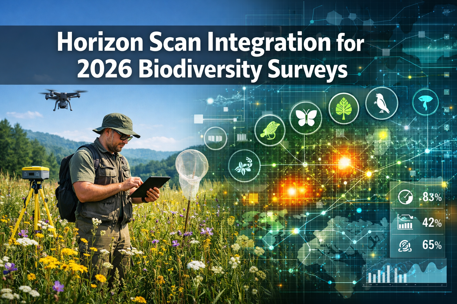
A panel of 26 global experts recently identified 15 priority conservation issues from an initial pool of 96 emerging threats—and the implications for biodiversity surveying practices have never been more urgent. As ecological challenges evolve at unprecedented speed, from mirror biomolecules to pharmaceutical-driven habitat shifts, surveyors can no longer rely on traditional monitoring frameworks alone. The Horizon Scan Integration for 2026 Biodiversity Surveys: Ecologist Protocols from Ecological Society Hot Topics represents a fundamental shift in how field professionals approach biodiversity assessment, embedding forward-looking threat detection into everyday survey work.
This integration methodology transforms reactive monitoring into proactive conservation intelligence. By incorporating emerging issues identified through systematic horizon scanning—including novel pollutants, technological disruptions, and unexpected land-use drivers—ecologists can design surveys that capture tomorrow's threats today. For professionals working within Biodiversity Net Gain frameworks, this forward-thinking approach ensures that baseline assessments and monitoring protocols remain relevant as new conservation challenges emerge.
Key Takeaways
- 15 priority conservation issues identified through expert consensus provide a structured framework for updating 2026 survey protocols and monitoring strategies
- TinyML technology and optical AI chips enable real-time biodiversity detection in remote locations without internet connectivity, revolutionizing field data collection
- Novel emerging threats—including mirror biomolecules, pharmaceutical land-use impacts, and fiber optic infrastructure risks—require immediate integration into baseline survey methodologies
- Digital twin simulations and advanced monitoring technologies offer unprecedented opportunities for predictive conservation planning and evidence-based decision-making
- Proactive survey design incorporating horizon scan insights strengthens the scientific foundation for biodiversity impact assessments and net gain planning
Understanding the 2026 Horizon Scan Framework
The Horizon Scan Integration for 2026 Biodiversity Surveys: Ecologist Protocols from Ecological Society Hot Topics builds upon a rigorous expert-driven process that evaluated 96 potential conservation issues. This systematic approach, coordinated by leading ecological societies and research institutions, employed a structured scoring methodology where specialists assessed each issue's potential impact, novelty, and urgency[3][4].
The Expert Panel Process
The horizon scanning methodology followed a three-stage refinement process:
- Initial Assessment: 26 international experts independently scored 96 candidate issues across multiple criteria
- Workshop Deliberation: The panel convened to discuss and debate the top 35 highest-scoring issues
- Priority Selection: Through consensus-building, experts identified 15 critical issues requiring immediate attention from the conservation community[3][4]
This structured approach ensures that the resulting priority list reflects genuine emerging threats rather than simply amplifying well-known concerns. The methodology specifically targets novel issues that may not yet be widely recognized within mainstream conservation discourse.
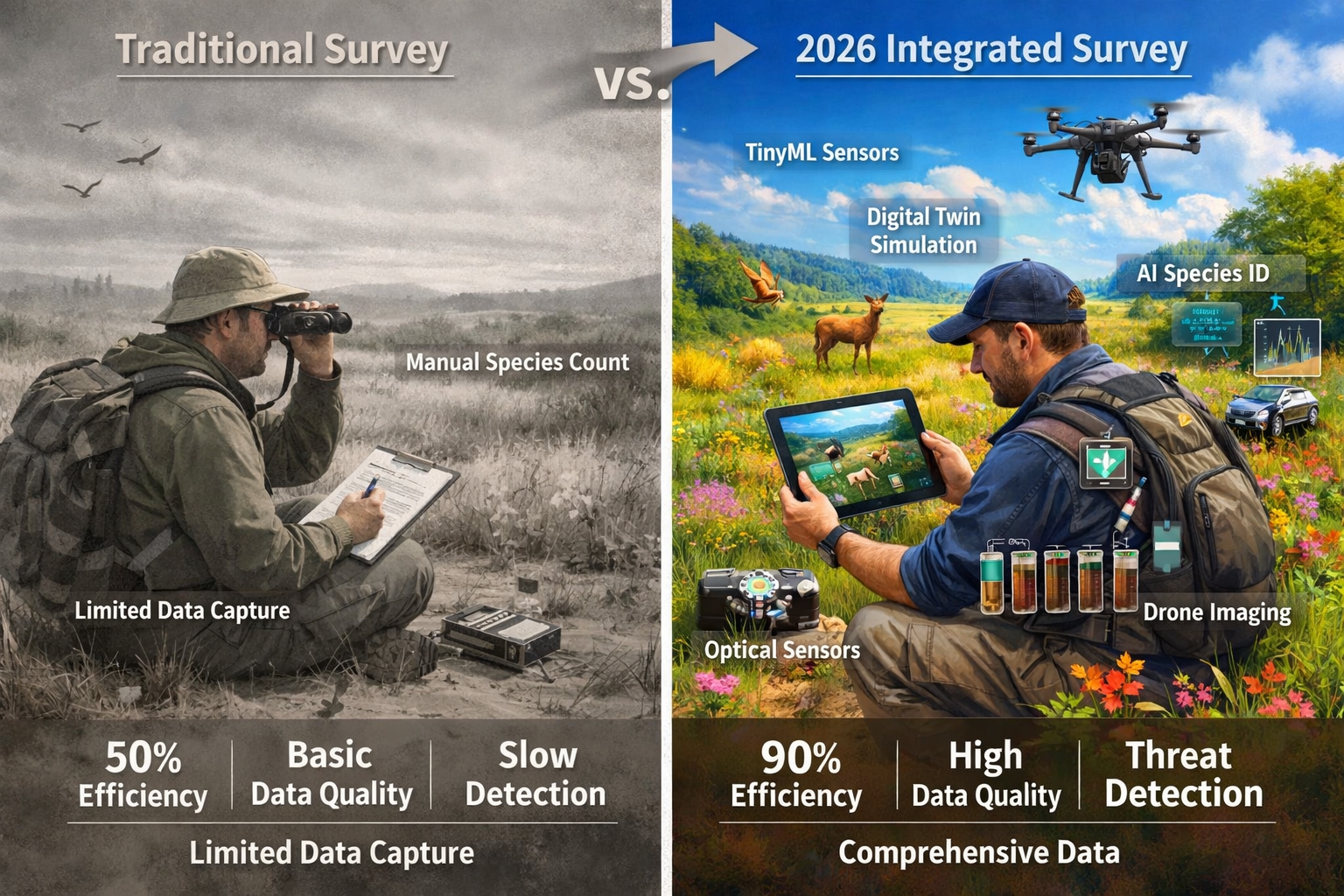
Why Horizon Scanning Matters for Field Surveyors
Traditional biodiversity surveys often focus on established threats—habitat fragmentation, invasive species, pollution from known sources. However, conservation challenges evolve continuously. What worked for baseline assessments five years ago may miss critical emerging pressures that will shape ecosystem health over the next decade.
Horizon scan integration provides several key advantages:
- 🔍 Early Warning System: Identifies threats before they become widespread, allowing preventive rather than reactive management
- 📊 Evidence Gaps: Highlights areas where current monitoring protocols lack data collection mechanisms
- 🎯 Targeted Protocols: Enables surveyors to design field methodologies that specifically capture emerging threat indicators
- 💡 Innovation Adoption: Directs attention to new technologies and approaches that enhance survey effectiveness
For professionals developing biodiversity plans for development projects, incorporating horizon scan insights ensures that mitigation strategies address both current and anticipated future pressures.
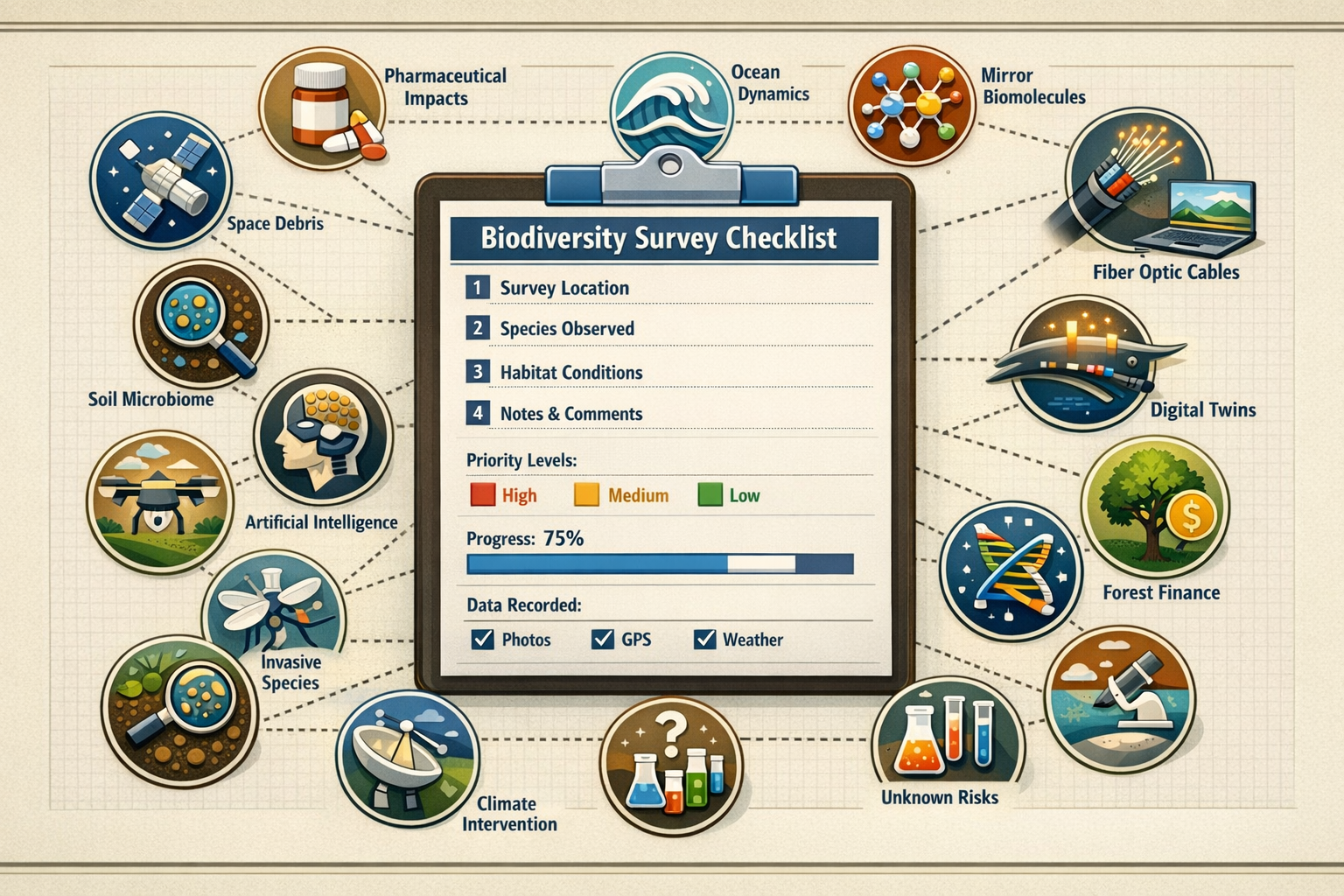
Priority Issues from the 2026 Horizon Scan
The 15 priority conservation issues identified for 2026 span technological innovations, environmental changes, and unexpected human activity impacts. Understanding these issues enables surveyors to adapt protocols proactively.
Technology-Driven Conservation Opportunities
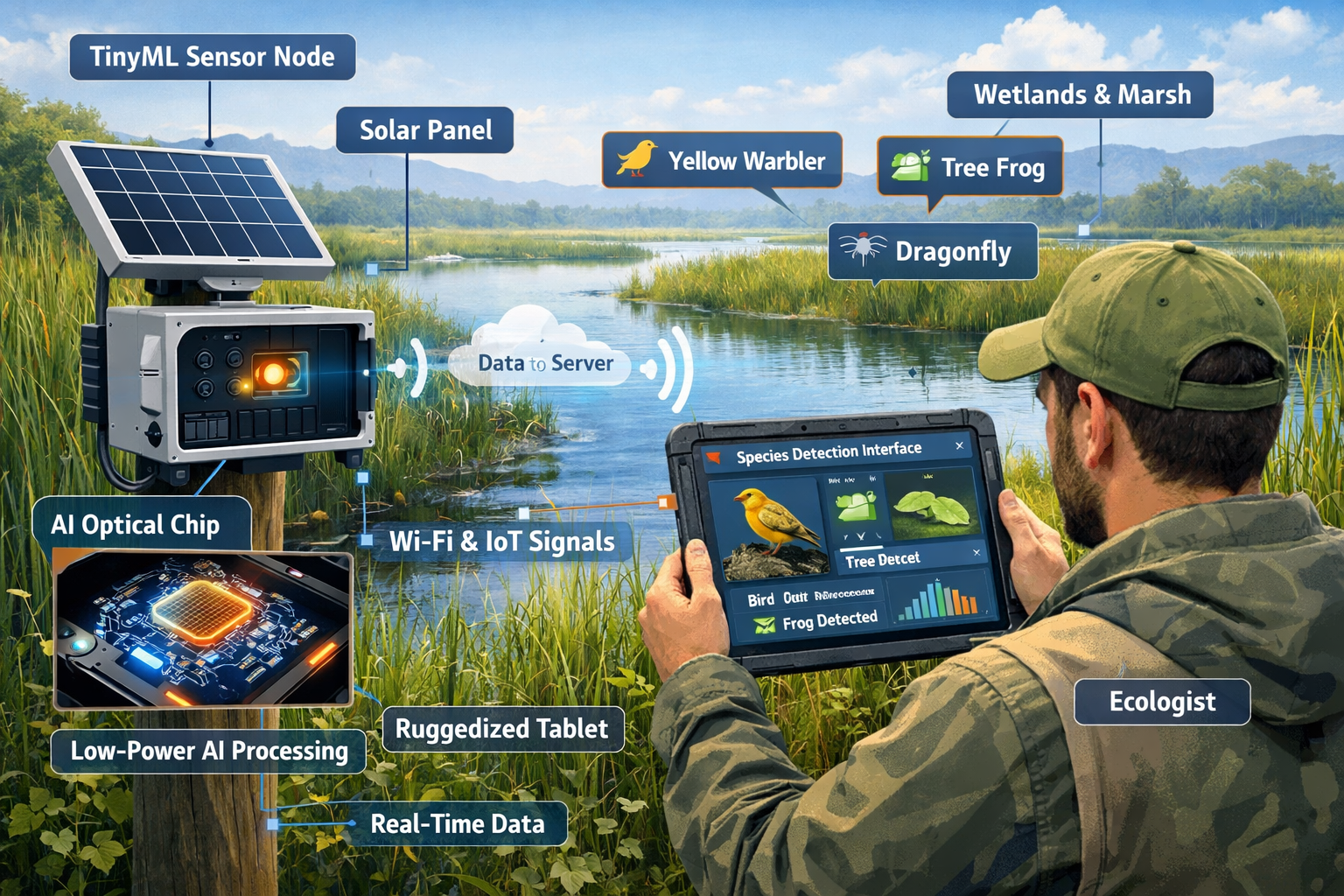
Tiny Machine Learning (TinyML) for Remote Monitoring 🤖
Low-power TinyML devices represent a breakthrough for biodiversity detection in remote landscapes. Unlike traditional monitoring systems requiring constant internet connectivity and substantial power infrastructure, these compact devices operate independently while performing real-time species identification and behavior analysis[1].
Key characteristics:
- Minimal energy requirements (often solar-powered)
- No internet dependency for basic operations
- On-device AI processing for immediate species detection
- Deployment feasible in previously inaccessible locations
Optical AI Chips for Enhanced Detection
Advanced optical artificial intelligence chips require minimal energy while delivering sophisticated analytical capabilities. These innovations enable continuous monitoring at scales previously impossible with conventional equipment[3][4].
Digital Twin Technology for Ecosystem Modeling
Computer simulations that mirror real-world ecosystems—known as digital twins—emerged as a priority conservation tool. These virtual replicas allow ecologists to model intervention outcomes, predict ecosystem responses to stressors, and optimize management strategies before implementing field actions[1].
Environmental and Biophysical Changes
Southern Ocean Dynamics
Significant biophysical changes across the Southern Ocean affect global biodiversity patterns, with implications extending far beyond polar regions. Ocean circulation alterations influence nutrient distribution, species migration patterns, and climate regulation services[1].
Deep-Sea Mining Impacts
As commercial interest in deep-sea mineral extraction intensifies, potential biodiversity damage from mining operations requires immediate monitoring protocol development. Current survey methodologies often inadequately capture deep-sea ecosystem baseline conditions[1].
Novel Anthropogenic Pressures
Pharmaceutical-Driven Land-Use Changes 💊
The horizon scan identified appetite-suppressing pharmaceuticals as an unexpected driver of land-use pattern shifts. As these medications affect food demand and agricultural production, cascading effects on habitat conversion and agricultural intensification require monitoring[3][4].
Mirror Biomolecule Effects
The development of mirror cells—synthetic organisms built from mirror-image biological molecules—presents unknown risks to natural ecosystems. These engineered life forms could interact with native biodiversity in unpredictable ways, necessitating precautionary monitoring protocols[3][4].
Fiber Optic Infrastructure Risks
Drone-deployed fiber optic cables, while offering communication benefits, create novel biodiversity threats through habitat disturbance and wildlife entanglement. This emerging infrastructure type wasn't considered in traditional environmental impact frameworks[1].
Resource and Economic Shifts
Global Food Demand Pattern Changes
Shifting dietary preferences, population growth, and climate adaptation strategies drive fundamental changes in global food systems. These transitions reshape agricultural landscapes and conservation priorities[1][2].
Forest Finance Mechanisms
Innovative financial instruments for forest conservation—including carbon markets and biodiversity credits—create new incentives but also potential perverse outcomes requiring careful monitoring. Understanding how these mechanisms affect on-ground conservation outcomes is critical for biodiversity unit markets[1][2].
Plastic-Derived Food Production
Emerging technologies converting plastic waste into food products could reduce pollution while creating new agricultural paradigms. However, the biodiversity implications of this novel production system remain poorly understood[1].
Soil and Ecosystem Function Issues
Soil Microbiome Interventions
The effectiveness of soil inoculation—introducing beneficial microorganisms to enhance ecosystem function—requires rigorous evidence synthesis. As this practice gains commercial traction, surveyors need protocols to assess actual ecological outcomes versus marketing claims[1].
Practical Protocols: Integrating Horizon Scan Insights into Survey Design
Translating horizon scan findings into actionable field protocols requires systematic integration at multiple stages of survey planning and execution. The following frameworks provide practical guidance for ecologists implementing Horizon Scan Integration for 2026 Biodiversity Surveys: Ecologist Protocols from Ecological Society Hot Topics.
Pre-Survey Planning Checklist
Phase 1: Threat Landscape Assessment
Before designing survey methodologies, conduct a site-specific threat analysis:
✅ Review local development plans for pharmaceutical manufacturing facilities, data infrastructure projects, or novel agricultural operations
✅ Assess proximity to ocean systems if coastal/marine elements present
✅ Identify existing or planned fiber optic/telecommunications infrastructure
✅ Evaluate soil management history and potential for microbiome interventions
✅ Research regional food system transitions affecting agricultural land use
Phase 2: Technology Integration Assessment
Determine which emerging monitoring technologies suit your survey context:
| Technology | Best Applications | Implementation Considerations |
|---|---|---|
| TinyML Devices | Remote sites, continuous monitoring, species-specific detection | Initial setup cost, species training data requirements |
| Optical AI Chips | High-frequency sampling, energy-limited locations | Technical expertise for deployment |
| Digital Twin Models | Complex ecosystems, intervention planning, predictive analysis | Substantial data requirements, modeling expertise |
| Drone-Based Sensors | Large area coverage, habitat mapping, inaccessible terrain | Regulatory permissions, weather dependency |
Phase 3: Protocol Modification
Adapt standard survey protocols to capture emerging threat indicators:
🔹 Baseline Surveys: Add data fields for novel pollutant indicators, pharmaceutical residues in water samples, and microplastic presence
🔹 Habitat Assessment: Document fiber optic infrastructure presence and routing through sensitive areas
🔹 Soil Sampling: Include microbiome analysis capacity if soil inoculation products used on-site
🔹 Water Quality: Expand testing panels to include pharmaceutical compounds and novel chemical signatures
Field Implementation Strategies
Deploying TinyML Monitoring Systems
For projects requiring long-term biodiversity monitoring, TinyML devices offer unprecedented continuous data collection:
Installation Protocol:
- Identify optimal placement locations based on target species behavior
- Ensure solar exposure for power sustainability
- Configure species detection parameters using local reference libraries
- Establish data retrieval schedule (weekly to monthly depending on storage capacity)
- Validate detection accuracy through traditional survey cross-referencing
Data Integration Approach:
- Combine TinyML automated detection with periodic expert verification
- Use continuous data to identify temporal patterns missed by snapshot surveys
- Feed detection data into digital twin models for predictive analysis
Addressing Novel Threat Indicators
When surveying sites potentially affected by horizon scan priority issues:
Pharmaceutical Impact Zones:
- Sample water bodies downstream from pharmaceutical facilities
- Document vegetation community shifts potentially linked to pharmaceutical residues
- Monitor wildlife behavior changes in areas with high pharmaceutical detection
- Coordinate with toxicology specialists for compound-specific analysis
Infrastructure Disturbance Assessment:
- Map fiber optic and telecommunications infrastructure routes
- Document wildlife movement patterns relative to cable locations
- Assess habitat fragmentation caused by infrastructure corridors
- Monitor for entanglement incidents or collision risks
Soil Intervention Monitoring:
- Establish control plots in areas without soil inoculation
- Compare microbial community composition between treated and untreated areas
- Track plant community responses to inoculation products
- Document any invasive species establishment linked to introduced microorganisms
Data Management and Reporting
Structured Data Collection
Implement standardized data fields that facilitate horizon scan integration:
EMERGING THREAT ASSESSMENT FIELDS:
- Novel infrastructure present: [Yes/No] → Type: [____]
- Pharmaceutical compounds detected: [Yes/No] → Concentration: [____]
- Soil interventions applied: [Yes/No] → Product type: [____]
- Digital monitoring technology deployed: [Yes/No] → Type: [____]
- Mirror biomolecule research facilities within 5km: [Yes/No]
Reporting Framework
When preparing biodiversity impact assessments, include dedicated sections addressing horizon scan issues:
- Emerging Threat Summary: Brief overview of relevant horizon scan issues for the site
- Detection Methodology: Protocols used to assess emerging threats
- Findings: Results specific to novel pressures identified
- Recommendations: Mitigation measures addressing both traditional and emerging threats
- Monitoring Proposals: Long-term monitoring incorporating horizon scan considerations
Advanced Integration: Digital Twins and Predictive Modeling
The most sophisticated application of Horizon Scan Integration for 2026 Biodiversity Surveys: Ecologist Protocols from Ecological Society Hot Topics involves predictive modeling through digital twin technology.
Building Ecosystem Digital Twins
Digital twins create virtual replicas of real ecosystems, allowing "what-if" scenario testing without field experimentation risks. For biodiversity surveyors, this technology enables:
Baseline Modeling:
- Create digital representations of current ecosystem state using survey data
- Incorporate species interaction networks, habitat quality metrics, and environmental variables
- Validate model accuracy against observed ecological patterns
Threat Scenario Testing:
- Simulate pharmaceutical pollution impacts on aquatic communities
- Model infrastructure development effects on wildlife movement corridors
- Predict soil microbiome intervention outcomes across different habitat types
- Assess cumulative impacts from multiple emerging threats
Intervention Optimization:
- Test restoration approach effectiveness before implementation
- Identify optimal locations for biodiversity net gain delivery
- Refine management strategies based on predicted outcomes
Integrating TinyML Data Streams
Digital twins gain predictive power when fed continuous real-time data from TinyML monitoring networks:
Data Flow Architecture:
- TinyML devices collect continuous species detection and environmental data
- Periodic data downloads transfer information to central database
- Digital twin model ingests new data, updating ecosystem state representation
- Model generates predictions about ecosystem trajectory
- Alerts trigger when predictions indicate concerning trends
This integration transforms static survey snapshots into dynamic ecosystem understanding, enabling adaptive management responses to emerging threats.
Sector-Specific Applications and Case Studies
Different professional contexts require tailored approaches to horizon scan integration.
Development Projects and Net Gain Planning
For developers and planners working within Biodiversity Net Gain requirements, horizon scan integration strengthens project outcomes:
Pre-Development Baseline Surveys:
- Incorporate emerging threat indicators into baseline condition assessments
- Document existing novel infrastructure that may affect biodiversity outcomes
- Assess soil condition including any previous microbiome interventions
- Establish TinyML monitoring networks for long-term data collection
Net Gain Delivery Sites:
- Evaluate potential emerging threats at proposed off-site delivery locations
- Use digital twin modeling to optimize habitat creation designs
- Implement continuous monitoring using low-power AI technologies
- Plan adaptive management responses to horizon scan priority issues
Monitoring and Verification:
- Deploy TinyML networks for cost-effective long-term monitoring
- Track emerging threat indicators alongside traditional biodiversity metrics
- Use digital twins to verify that biodiversity outcomes match predictions
- Adjust management approaches based on real-time data insights
Agricultural and Rural Land Management
Landowners considering biodiversity unit creation benefit from horizon scan awareness:
Baseline Assessment Enhancements:
- Document current soil microbiome status before intervention programs
- Assess pharmaceutical residue levels in agricultural water sources
- Map existing telecommunications infrastructure affecting habitat connectivity
- Evaluate food production system transitions affecting land use
Habitat Creation Planning:
- Consider forest finance mechanisms when designing woodland creation projects
- Plan for climate-driven food demand shifts affecting agricultural viability
- Integrate soil health interventions with biodiversity enhancement goals
- Use digital modeling to optimize habitat network design
Conservation Organizations and Reserve Management
Protected area managers gain strategic advantages through horizon scan integration:
Threat Monitoring Programs:
- Establish TinyML networks for continuous biodiversity monitoring
- Develop protocols for detecting mirror biomolecule contamination
- Monitor ocean dynamics impacts on coastal reserves
- Track pharmaceutical pollution in aquatic systems
Adaptive Management Frameworks:
- Use digital twins to model reserve management scenarios
- Test intervention effectiveness before costly implementation
- Predict ecosystem responses to emerging threats
- Optimize resource allocation based on predictive modeling
Implementation Challenges and Solutions
Integrating horizon scan insights into practical survey work presents several challenges requiring strategic solutions.
Technical Capacity Gaps
Challenge: Many surveyors lack training in TinyML deployment, digital twin modeling, or novel pollutant detection.
Solutions:
- Partner with technology specialists for initial deployments
- Pursue professional development in emerging monitoring technologies
- Collaborate with academic institutions conducting relevant research
- Join professional networks sharing horizon scan integration experiences
Resource Constraints
Challenge: Advanced monitoring technologies and specialized testing require budget increases.
Solutions:
- Phase technology adoption, starting with highest-priority sites
- Leverage government consultation outcomes supporting innovation in biodiversity monitoring
- Demonstrate cost-effectiveness of continuous monitoring versus repeated manual surveys
- Seek research partnerships providing equipment access
- Pool resources across multiple projects for shared monitoring infrastructure
Data Interpretation Complexity
Challenge: Novel data streams from emerging technologies require new analytical approaches.
Solutions:
- Develop standardized data interpretation frameworks
- Establish expert review processes for unusual findings
- Create reference databases for emerging threat indicators
- Build collaborative networks for data interpretation support
Regulatory Uncertainty
Challenge: Existing biodiversity assessment frameworks may not explicitly require emerging threat consideration.
Solutions:
- Proactively incorporate horizon scan issues into voluntary best practices
- Demonstrate added value to planning authorities and clients
- Contribute to regulatory consultation processes shaping future requirements
- Document case studies showing improved conservation outcomes
Future-Proofing Survey Methodologies
The Horizon Scan Integration for 2026 Biodiversity Surveys: Ecologist Protocols from Ecological Society Hot Topics represents not a one-time protocol update but an ongoing commitment to adaptive survey design.
Continuous Learning Framework
Establish systems for ongoing horizon scan awareness:
📚 Annual Horizon Scan Review: Ecological societies conduct horizon scanning exercises annually—integrate new findings into protocol updates
🔄 Quarterly Protocol Refinement: Review and adjust survey methodologies based on emerging evidence
🤝 Professional Network Engagement: Participate in forums discussing emerging conservation challenges
📊 Data Sharing Initiatives: Contribute survey findings to collaborative databases tracking emerging threats
Building Organizational Capacity
Organizations committed to excellence in biodiversity surveying should:
- Invest in Technology Infrastructure: Acquire TinyML devices, analytical equipment for novel pollutants, and digital modeling capacity
- Develop Staff Expertise: Provide training in emerging monitoring technologies and threat assessment
- Establish Research Partnerships: Collaborate with universities and research institutions advancing conservation science
- Create Innovation Budgets: Allocate resources specifically for testing and implementing new methodologies
- Document Lessons Learned: Build institutional knowledge about what works in horizon scan integration
Advocacy and Industry Leadership
Professional surveyors can shape the evolution of biodiversity assessment standards:
- Contribute expertise to regulatory consultations on monitoring requirements
- Present case studies demonstrating horizon scan integration benefits
- Publish findings in professional journals and practitioner forums
- Mentor emerging professionals in forward-thinking survey approaches
- Advocate for recognition of emerging threats in planning guidance
Conclusion
The Horizon Scan Integration for 2026 Biodiversity Surveys: Ecologist Protocols from Ecological Society Hot Topics transforms biodiversity assessment from reactive documentation to proactive conservation intelligence. By incorporating the 15 priority issues identified through systematic expert analysis—from TinyML monitoring capabilities to pharmaceutical land-use impacts—surveyors strengthen the scientific foundation for conservation decision-making.
This integration approach delivers tangible benefits across professional contexts. Developers gain more robust baseline assessments supporting biodiversity net gain compliance. Landowners optimize habitat creation strategies using predictive modeling. Conservation managers detect emerging threats before they compromise protected area integrity.
Actionable Next Steps
For Individual Surveyors:
- Review the 15 priority horizon scan issues and assess relevance to your survey contexts
- Identify one emerging monitoring technology (TinyML, digital twins, or novel pollutant testing) to pilot on upcoming projects
- Add emerging threat assessment fields to standard survey data collection templates
- Join professional networks discussing horizon scan integration experiences
For Organizations:
- Conduct internal capacity assessment identifying technology and training gaps
- Allocate budget for emerging monitoring technology acquisition and staff development
- Establish partnerships with technology providers and research institutions
- Develop case studies documenting horizon scan integration benefits for client communication
For the Broader Conservation Community:
- Contribute survey data to collaborative databases tracking emerging threats
- Participate in regulatory consultations advocating for forward-thinking monitoring standards
- Share lessons learned through professional publications and presentations
- Support continued horizon scanning efforts identifying future conservation challenges
The ecological challenges of 2026 and beyond demand survey methodologies that anticipate rather than merely document biodiversity change. By embracing horizon scan integration, the professional surveying community positions itself at the forefront of conservation innovation—transforming field data collection into strategic intelligence that shapes effective, evidence-based conservation action.
For guidance on implementing these advanced protocols within your specific project context, contact specialized biodiversity survey professionals who can tailor horizon scan integration approaches to your unique requirements.
References
[1] Whats Next For Biodiversity Conservation Insights From The 2026 Horizon Scan – https://www.unep-wcmc.org/en/news/whats-next-for-biodiversity-conservation-insights-from-the-2026-horizon-scan
[2] A Horizon Scan Of Biological Conservation Issues For 2026 – https://www.besnet.world/library/a-horizon-scan-of-biological-conservation-issues-for-2026/
[3] A Horizon Scan Of Biological Conservation Issues For 2026 – https://www.bas.ac.uk/data/our-data/publication/a-horizon-scan-of-biological-conservation-issues-for-2026/
[4] pubmed.ncbi.nlm.nih.gov – https://pubmed.ncbi.nlm.nih.gov/41339143/
